The Challenge
Alexander Schmitt doesn't have an easy operating environment. As co-owner and drone pilot at ADVOLARE SkyView, he flies commercial missions across the canton of Graubünden — one of the most mountainous, geographically demanding regions in Switzerland. His team handles everything from industrial site surveying and chimney inspections to wildlife documentation for cantonal authorities. Every one of these jobs requires precise, georeferenced positioning data.
"For these surveying tasks, a reliable RTK signal is critical to achieve the accuracy we need. The documentation and later analysis depend on it."Alexander Schmitt, Co-Owner & Drone Pilot, ADVOLARE GmbH
The problem wasn't whether RTK technology could deliver that accuracy. The problem was how to get it reliably and affordably across a growing drone fleet operating in remote alpine locations.
The Pain Points
Expensive regional networks. Switzerland's established GNSS correction services — such as swipos — are reliable, but priced for the domestic market. For a growing drone operation adding new aircraft, per-device subscription costs add up quickly. Every new drone means another license.
Scaling costs with fleet growth. ADVOLARE was expanding its fleet beyond a single aircraft. Each additional aircraft needed its own RTK correction access, turning an expensive line item into a scaling problem.
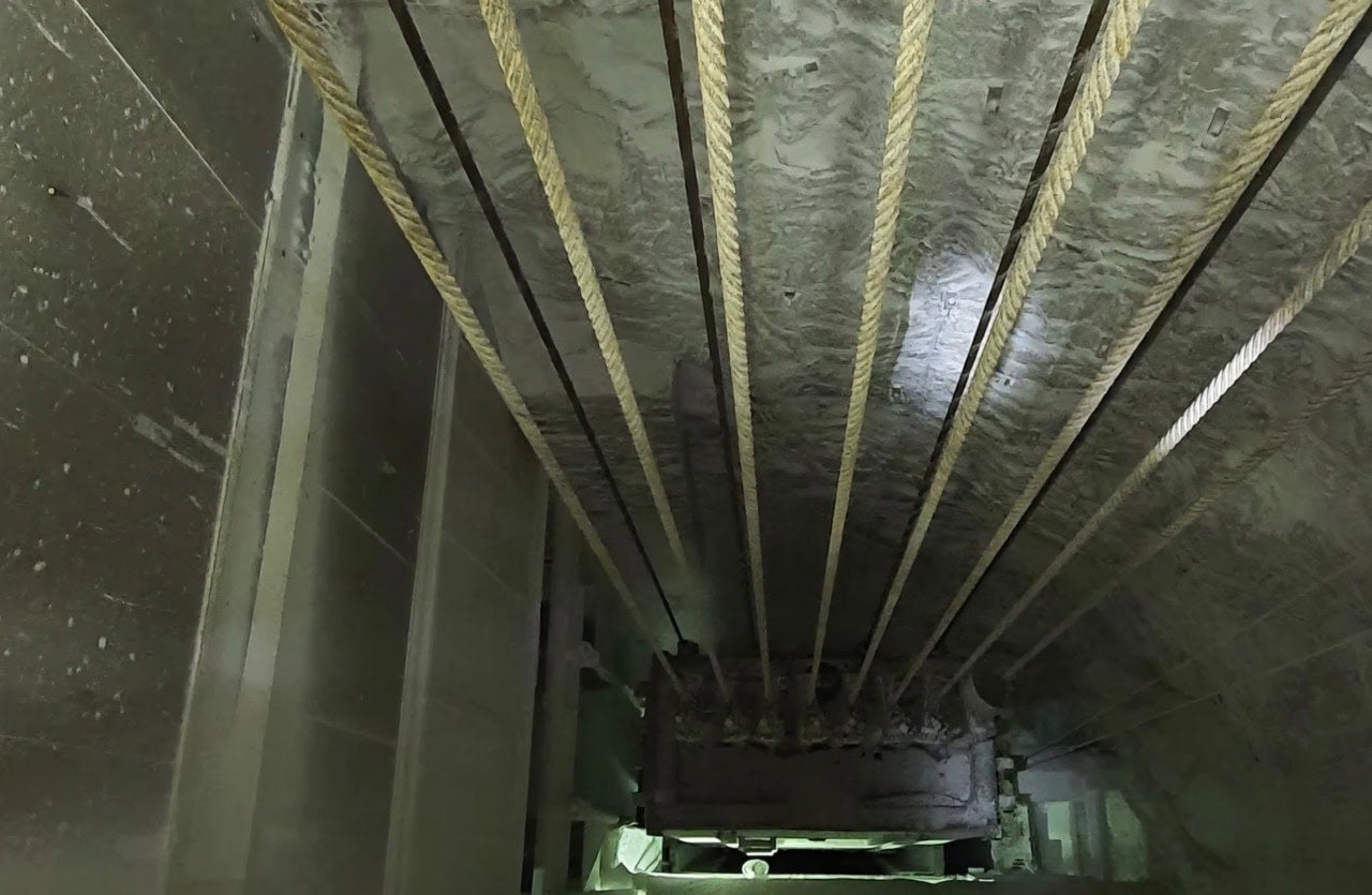
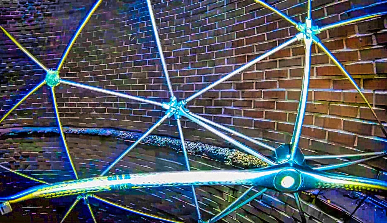
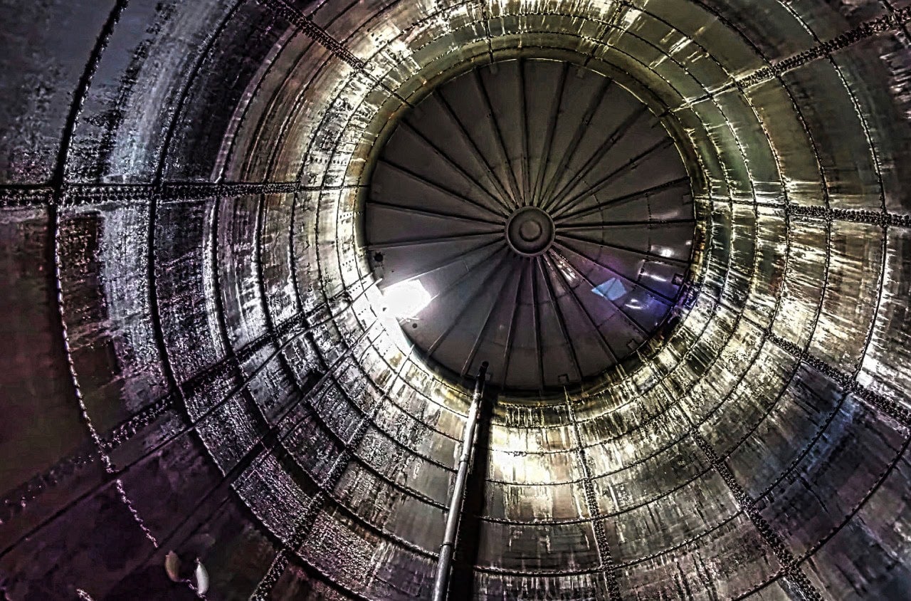
Harsh operating environments. Graubünden is not a flat agricultural plain. ADVOLARE's missions include inspecting industrial chimneys and shafts — confined spaces where maintaining any satellite signal is a challenge. RTK-level precision has to work not just in open sky, but inside structures where signal conditions are marginal.
Hardware diversity. As the fleet grew to include non-DJI models, Alex needed a correction service that was hardware-agnostic — one set of NTRIP credentials that would work across any RTK-capable receiver.
The Solution
Alex started testing RTKdata's NTRIP correction service with his DJI Matrice 4T — beginning with a free trial to validate performance in his actual operating conditions before committing.
Setup: Straightforward
The integration with DJI's built-in RTK module was simple: enter the NTRIP credentials (server, port, mountpoint, username, password) into the drone's RTK settings, and the aircraft connects to RTKdata's nearest virtual reference station automatically. No base station hardware to transport, set up, or calibrate on site.
For the DJI Matrice 4T and Matrice 4DT, the connection worked on the first attempt.
Real-World Testing, Not Lab Benchmarks
Alex didn't test in ideal conditions. He tested where he actually works:
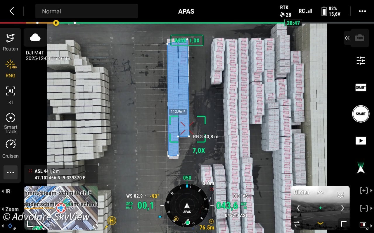
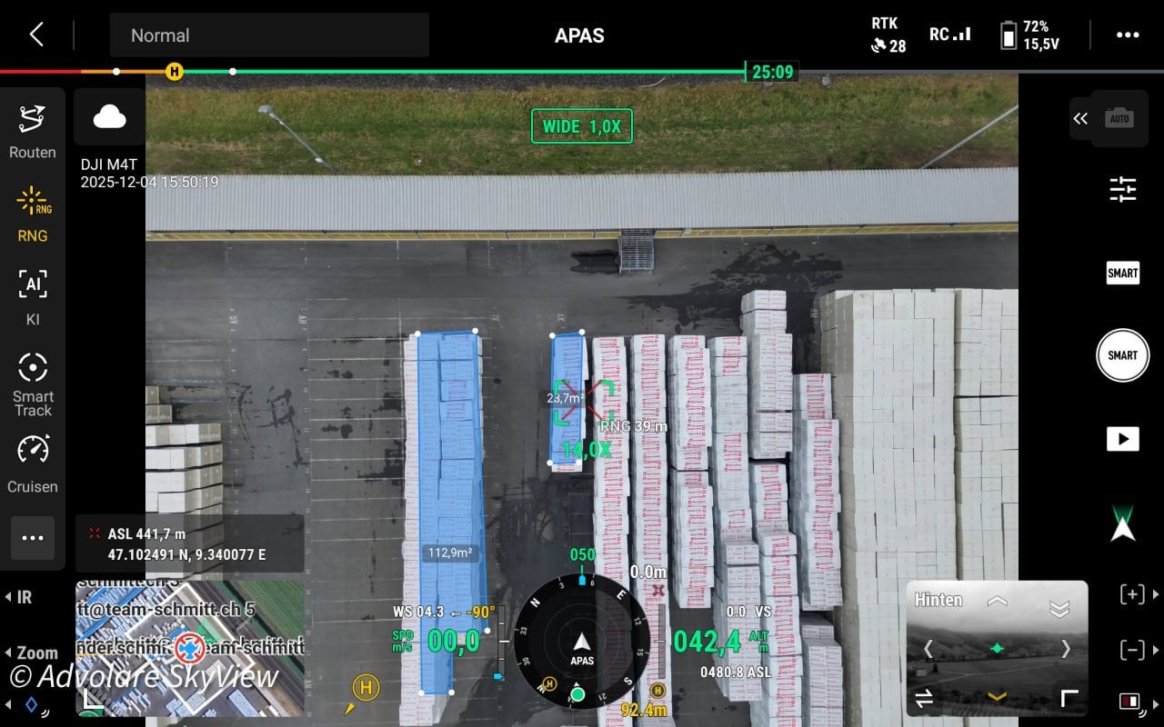
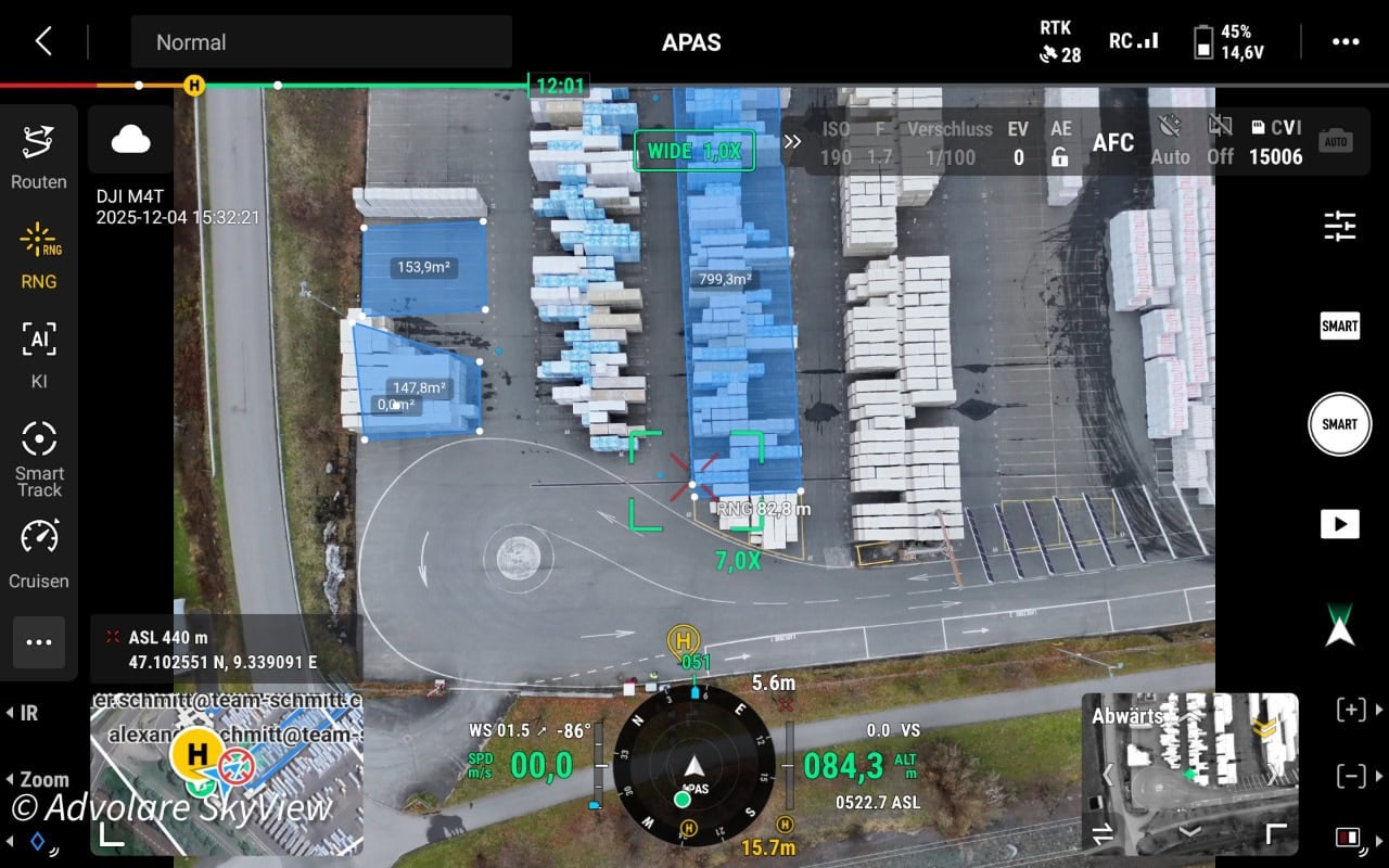
Outdoor Storage Yard Surveying
An industrial client needed precise aerial documentation of their outdoor storage areas — specifically, which inventory items occupy how many square meters. This requires centimeter-level accuracy for reliable area measurements from orthomosaic maps. Standard GPS would be useless for this purpose.
With RTKdata's NTRIP correction stream, the Matrice 4T achieved a stable RTK fix throughout the survey flight, delivering the positioning precision needed for accurate area calculations.
Industrial Site Documentation
Precise aerial documentation of large industrial sites requires consistent RTK fix across the entire survey area. The positioning data is critical for accurate measurements and later analysis of the captured imagery.
Across all survey flights, Alex was able to maintain RTK fix and meet the accuracy requirements for professional documentation.
The Results
Reliable RTK fix across challenging environments. RTKdata's NTRIP correction stream delivered stable positioning in alpine surveying and industrial site documentation. No outages. No correction dropouts. No base station logistics.
Cost advantage over Swiss regional networks. While specific figures are confidential, Alex's behavior tells the story: he's choosing DJI hardware with built-in RTK modules specifically because the NTRIP correction economics make the investment worthwhile.
Customer Testimonial
"The DJI Matrice 4T and the Matrice 4DT have shown how clean and reliable your RTK is."Alexander Schmitt, Co-Owner & Drone Pilot, ADVOLARE GmbH
"So far, with the DJI hardware, I've always been able to meet the minimum requirements for an RTK signal — which is enormously important for the documentation and later analysis."Alexander Schmitt, ADVOLARE GmbH
Technical Setup
| Component | Detail |
|---|---|
| Correction Service | RTKdata NTRIP RTK |
| Protocol | NTRIP / RTCM 3.2 |
| Constellations | GPS, GLONASS, Galileo, BeiDou |
| Drone 1 | DJI Matrice 4T (built-in RTK module) |
| Drone 2 | DJI Matrice 4DT (built-in RTK module) |
| Integration | Native NTRIP client in DJI RTK settings |
| Operating Region | Graubünden, Switzerland (alpine/rural) |
| Use Cases | Aerial surveying, industrial inspection, documentation |
| Base Station Required | None |
What's Next
ADVOLARE SkyView is expanding into fully autonomous drone operations. Alex will deploy three DJI Dock 3 docking stations paired with the DJI Matrice 4TD with RTK systems that operate without a pilot on site. In these scenarios, reliable NTRIP RTK corrections aren't optional, they're essential for the autonomous positioning accuracy these missions require. Initial autonomous flight tests without the Dock 3 have already delivered strong results, with both flight stability and positioning accuracy meeting professional requirements. As the fleet grows from piloted to autonomous operations, the same NTRIP correction infrastructure scales seamlessly with no additional base stations, no per-site hardware, just consistent centimeter-level accuracy across every mission.
For a growing commercial drone operation in one of Europe's most demanding geographic environments, the equation is simple: NTRIP RTK corrections eliminate base station logistics, reduce per-aircraft costs compared to regional Swiss networks, and deliver the accuracy that makes professional surveying and inspection data trustworthy.
Frequently Asked Questions
What accuracy does RTKdata NTRIP achieve with DJI Matrice 4T drones?
RTKdata's NTRIP RTK correction service delivers 1-2 cm horizontal accuracy with DJI Matrice 4T and Matrice 4DT drones, as verified in real-world alpine surveying conditions in Switzerland.
Does RTKdata work in mountainous terrain like the Swiss Alps?
Yes. ADVOLARE SkyView successfully uses RTKdata's NTRIP corrections for commercial drone surveying across Graubünden, one of Switzerland's most mountainous regions, achieving stable RTK fix in challenging alpine conditions.
Is a base station required when using RTKdata with DJI drones?
No. RTKdata provides network RTK corrections via NTRIP, eliminating the need for a physical base station. The DJI Matrice 4T and 4DT connect directly to RTKdata's nearest virtual reference station using built-in NTRIP client settings.