RTK for Drones:
Achieve 1-2 cm Accuracy
- 1-2 cm horizontal accuracy in real time
- Works with DJI, Skydio & any NTRIP receiver
- 20,000+ RTK Stations in 145+ Countries
- Setup in under 5 minutes. No base station needed
What Is RTK for Drones?
Flying Precise in 3 Steps
01
Choose a Plan
02
Enter NTRIP Credentials
03
Verify FIX
Start Your RTK Drone Workflow Today
Why Use RTK GPS for Drones?
RTK Drone Mapping & Survey
Eliminate ground control points and deliver survey-grade orthomosaics, point clouds, and 3D models. RTK drone mapping saves 30–60 minutes per mission and produces centimeter-accurate deliverables from the moment you land.
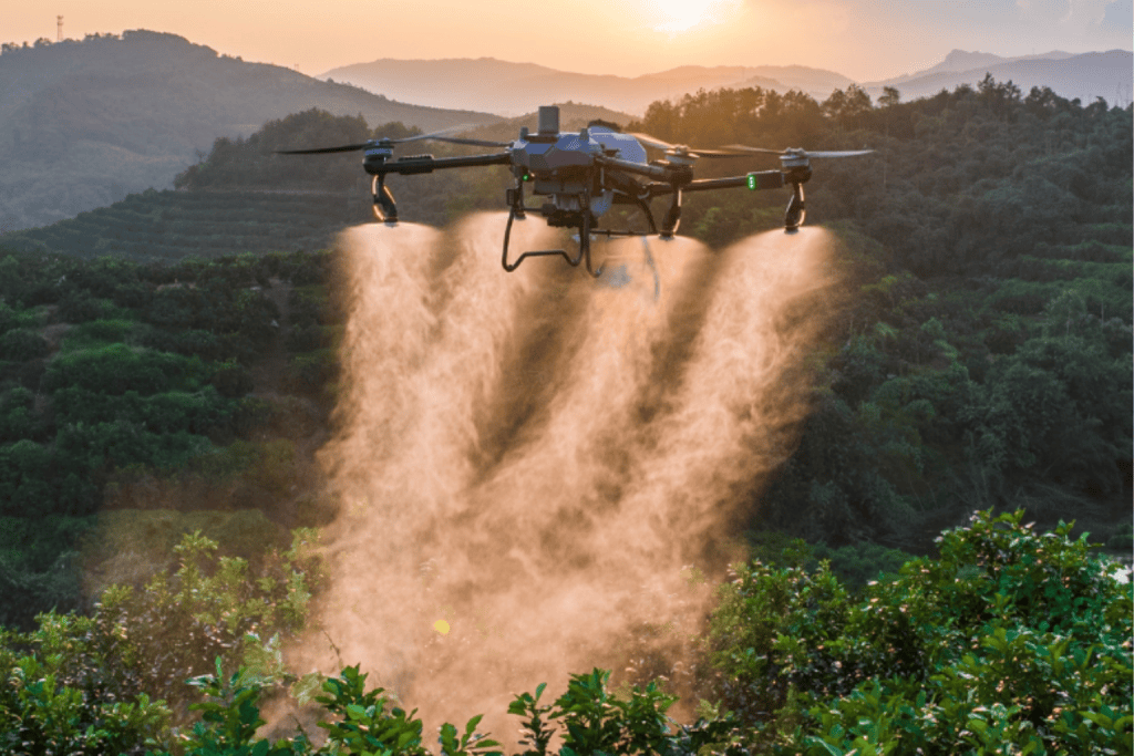
Precision Agriculture
RTK-enabled drones like the DJI Agras T50 achieve centimeteraccurate spray paths. Reducing chemical usage by up to 30%. Create precise NDVI maps, plan drainage, and estimate yields with survey-grade positioning.
Oil and Gas
RTK GPS for drones ensures every inspection flight over pipelines, rigs, and facilities uses the same coordinate reference. Critical for volumetric change detection and regulatory compliance documentation.
Construction and Infrastructure
Capture as-built data, track earthwork progress, and verify cut/fill volumes with centimeter accuracy. No base station to purchase, transport, or maintain. RTKdata provides corrections from a permanent reference network.
Compatible RTK Drones
DJI RTK Drones
| Drone | Use Case | Setup Guide |
|---|---|---|
| DJI Mavic 3 Enterprise RTK | Inspection, mapping, small-area survey | Setup Guide → |
| DJI Matrice 4 Enterprise RTK | Large-area mapping, corridor survey | Setup Guide → |
| DJI Phantom 4 RTK | Photogrammetry, legacy fleet | Setup Guide → |
| DJI Agras T50 / T40 / T25 | Precision agriculture spraying | Setup Guide → |
Autel RTK Drones
| Drone | Use Case | Setup Guide |
|---|---|---|
| Autel EVO II RTK | Mapping, inspection, surveying | Setup Guide → |
Other RTK-Capable Drones
| Drone / Platform | RTK Method | Notes |
|---|---|---|
| Skydio X10 | NTRIP via RTK attachment | Sub-1.5" RMS without GCPs |
| Freefly Astro / Astro Max | NTRIP via LTE (u-blox F9P) | No local base station needed |
| senseFly eBee RTK | NTRIP via eMotion software | Fixed-wing, large area coverage |
| Quantum Systems Trinity Pro | NTRIP RTK | 90+ min flight time, 700 ha per flight |
| Inspired Flight | NTRIP via RTK/PPK module | Streams corrections from controller |
| Acecore Zoe / Zetona | Network RTK via NTRIP (F9P) | Heavy-lift, 47 min flight time |
Ready to eliminate re-flights?
Trusted by Drone Operators Worldwide
“If you are like me and learning this somewhat confusing process involving RTK and
drones, support becomes a big issue. I submitted some questions to RTKdata and
was almost immediately answered, not by a bot, but by the big dog himself. I am
now confident in the product and the support. What could be better?”
Robert Fly
“Excellent and dependable RTK NTRIP service and customer service for a great
price. RTKData has been instrumental in capturing accurate drone maps in difficult
locations where known points are either hard to come by or difficult to access.”
Nathan Wiens — Wiens Consulting
“RTKdata’s team is ridiculously AWESOME! I sent in a question at 3am to get assistance with my drone mission later that morning. I literally got an answer in 10 minutes that helped resolve my problem and answer my questions. Lifelong customer!”
Derrick Angle — Anglesaerialstx
How Drone Operators Use RTKdata
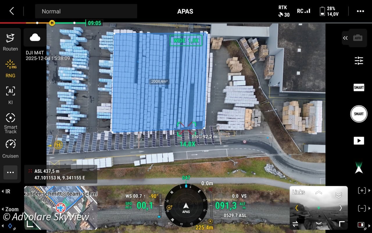
How ADVOLARE SkyView Achieves Centimeter-Accurate Drone Surveying in the Swiss Alps
ADVOLARE SkyView achieves centimeter-accurate drone surveying across the Swiss Alps using RTKdata’s NTRIP RTK corrections — replacing expensive regional networks for DJI Matrice 4T and 4DT missions.
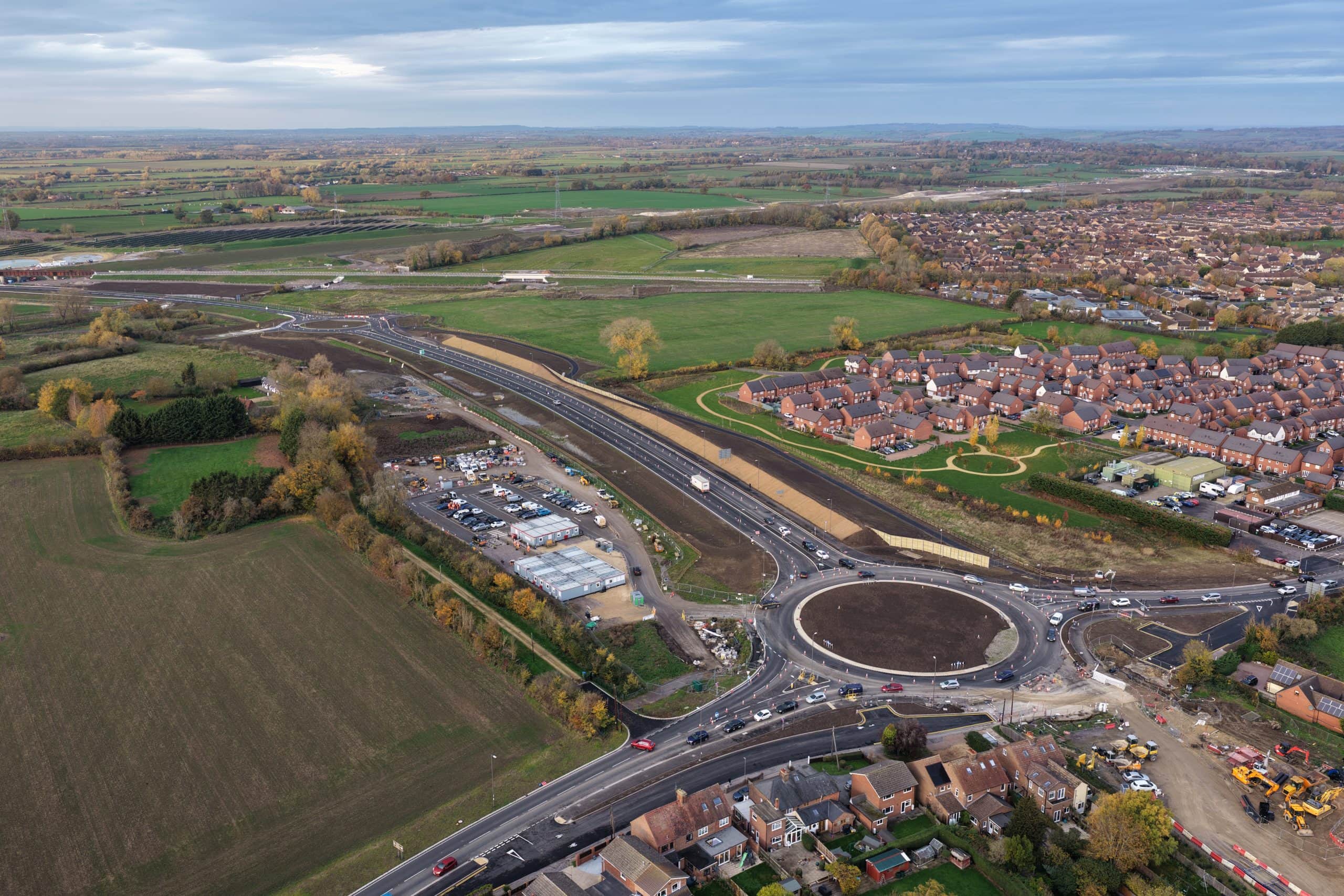
From RAF Veteran to RTK Drone Mapping Professional: How Sky Eye Imagery Delivers Centimeter-Accurate Surveys
Sky Eye Imagery delivers RTK drone mapping with 1-2 cm accuracy for UK infrastructure projects — using RTKdata’s NTRIP correction service at a fraction of previous costs.
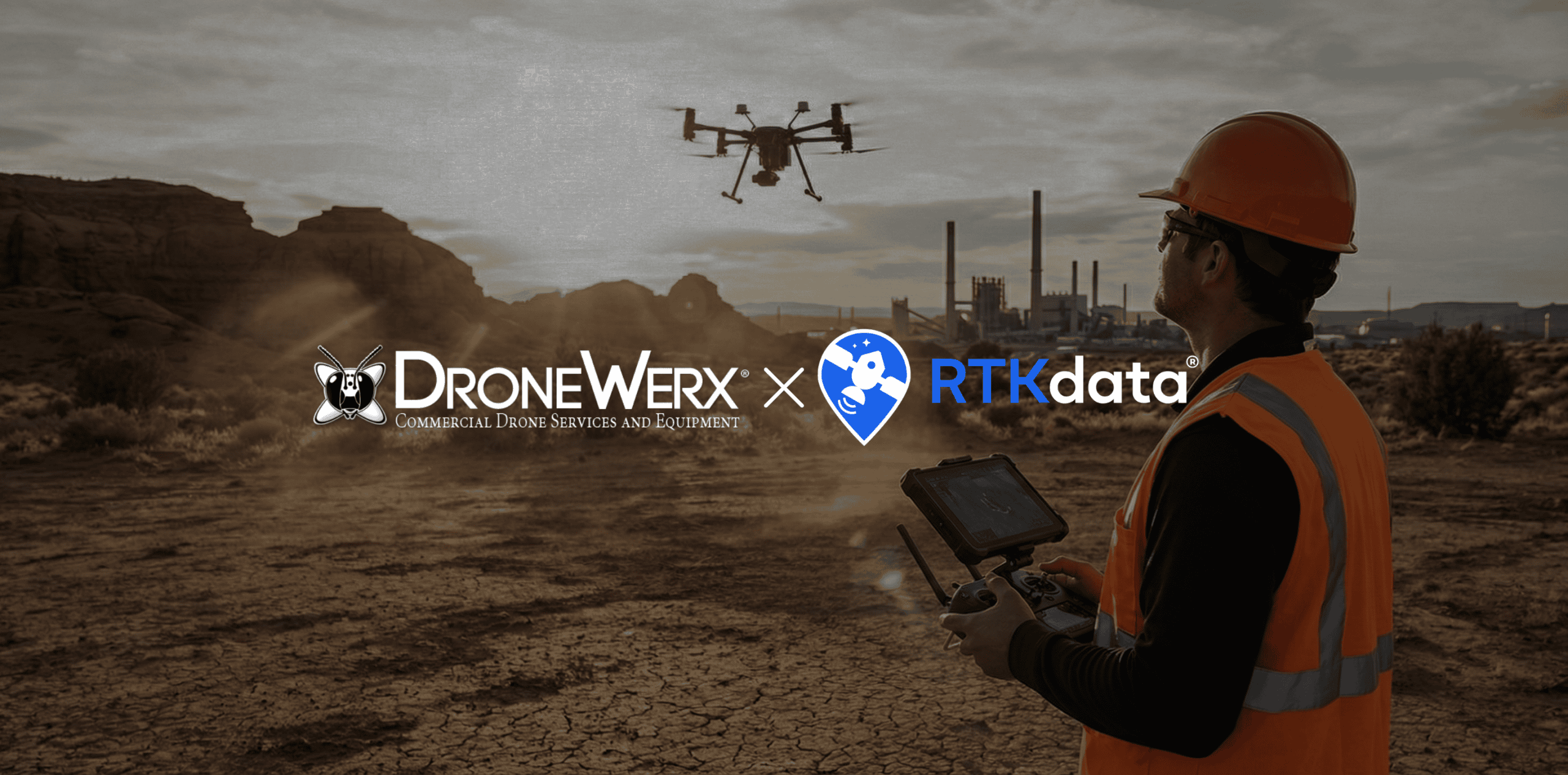
DRONEWERX Accelerates RTK Drone Mapping in Southern Nevada with RTKdata
RTK drone mapping at scale works best when you remove field overhead: no GCPs, no local base station, just network RTK via NTRIP. This case study shows how DRONEWERX cut on-site time and cost while delivering repeatable, centimeter-level mapping results in Southern Nevada.