The Challenge
Building a Professional Drone Business After the Military
Bitu Williams spent years in the Royal Air Force as a qualified imagery analyst — interpreting aerial imagery for military operations. When he left the RAF in 2024, he knew exactly where his skills could translate: commercial drone mapping.
He founded Sky Eye Imagery in Aylesbury, Buckinghamshire, with a stack of professional certifications — CAA GVC pilot license, Level 4 Diploma in Piloting Unmanned Aerial Vehicles, Level 4 Specialist in Thermography. The qualifications were solid. But his clients — architects, land surveyors, civil engineers — need centimeters, not meters.
The Accuracy Problem Is a Business Problem
Bitu's clients weren't just viewing aerial photos. They were:
- Making planning decisions based on site dimensions and elevations
- Submitting data to local authorities as part of formal planning applications
- Using survey outputs in planning disputes — where centimeters matter in boundary arguments
- Planning demolitions where accurate 3D models are essential for safety
Existing RTK correction providers in the UK charged rates that cut deeply into a bootstrapped startup's margins. Bitu needed survey-grade accuracy at a price that wouldn't kill the business.
The Solution
NTRIP RTK Corrections — No Base Station Required
In mid-2025, Bitu discovered RTKdata's NTRIP correction service. The setup matched exactly what a mobile drone operator needs: subscribe online, enter credentials into the drone's RTK settings, fly with centimeter-level positioning. No base station to transport. No post-processing delays.
"It was very easy to setup and get the drone to connect to the service quickly."Bitu Williams, Founder, Sky Eye Imagery
With reliable and affordable corrections in place, Bitu scaled his equipment from a DJI Mini 3 Pro to professional RTK-capable mapping drones with electro-optical and thermal capabilities — opening additional revenue streams in building inspections, solar panel audits, and infrastructure assessments.
The Results
Professional-Grade Accuracy That Clients Verify
The most important metric in aerial survey work is RMSE — Root Mean Square Error. Bitu's clients don't take accuracy claims on faith. They check.
"All of my customers have been very impressed by the RMSE of the final product and this is thanks to RTK Data."Bitu Williams, Sky Eye Imagery
Cost Reduction Without Accuracy Compromise
"Affordable and just as accurate if not more than some of the other ones I have tried that cost quite a bit more."Bitu Williams, Sky Eye Imagery
Real Projects, Real Impact
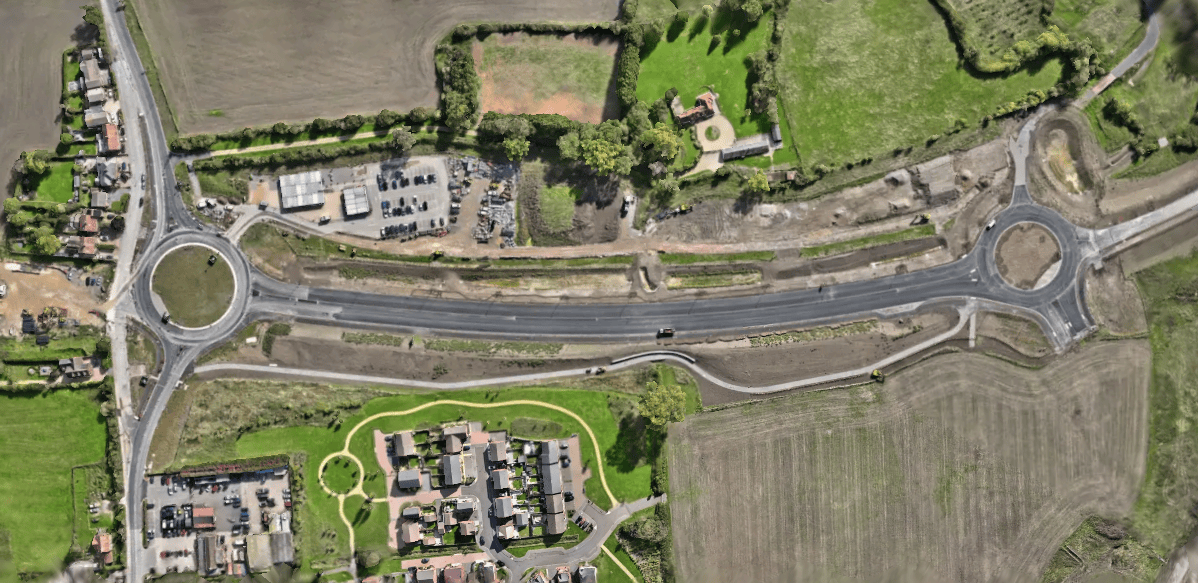
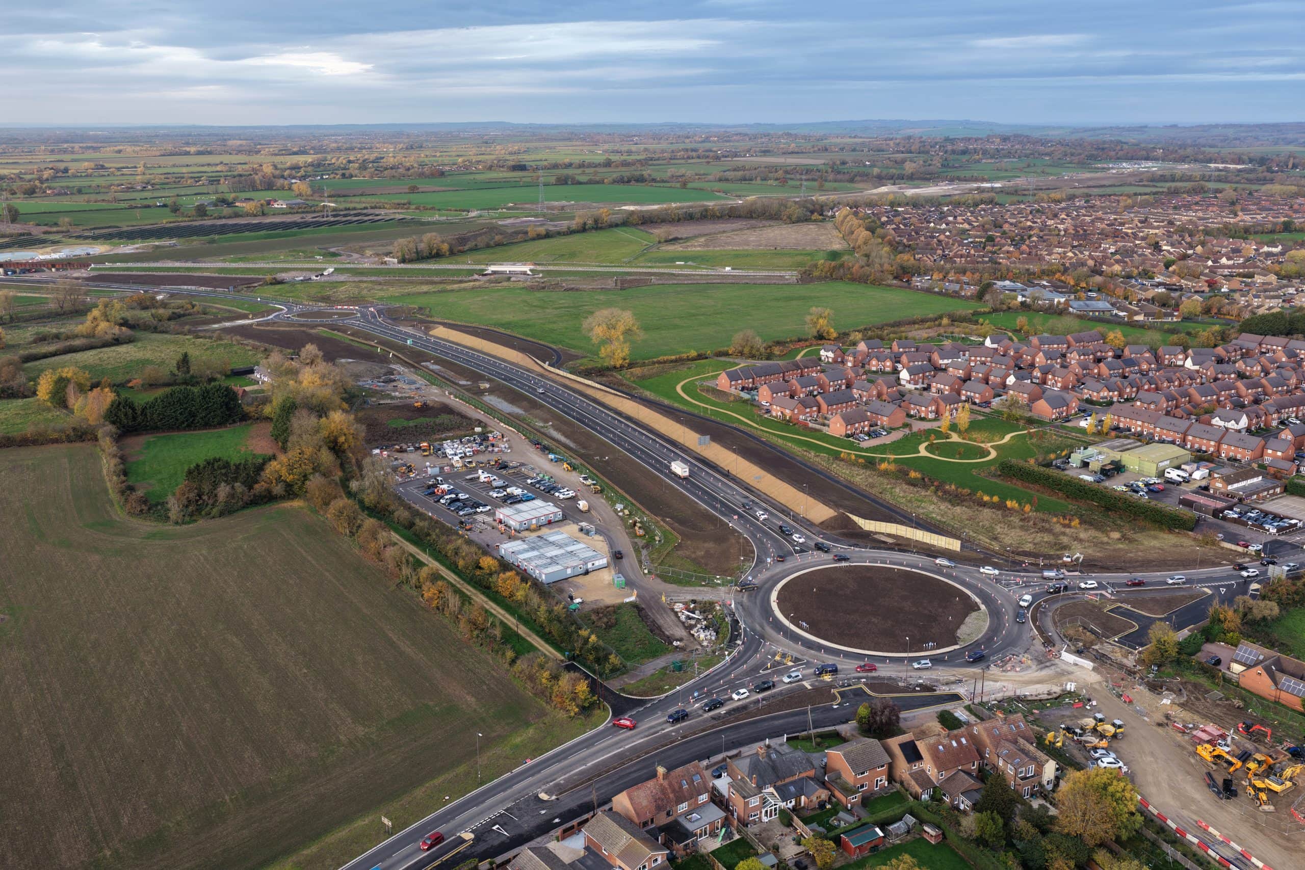
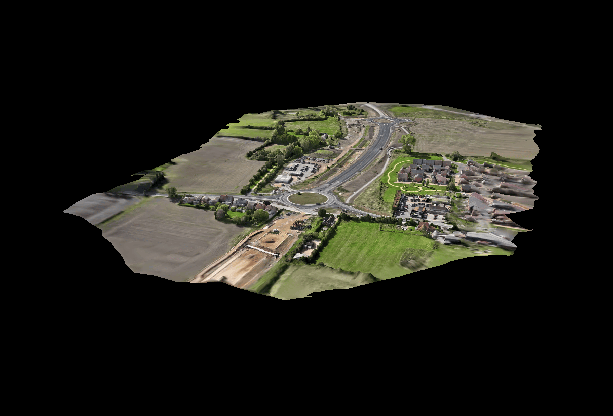
SEALR — Infrastructure Mapping
Aerial mapping and progress monitoring for a major road construction project in Buckinghamshire.
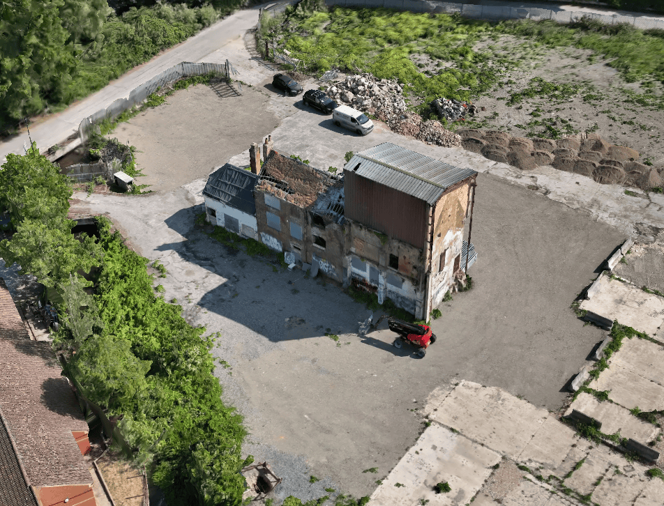
The Old Mill — Demolition Planning
Detailed 3D model from RTK drone data for safe demolition planning of a heritage structure.
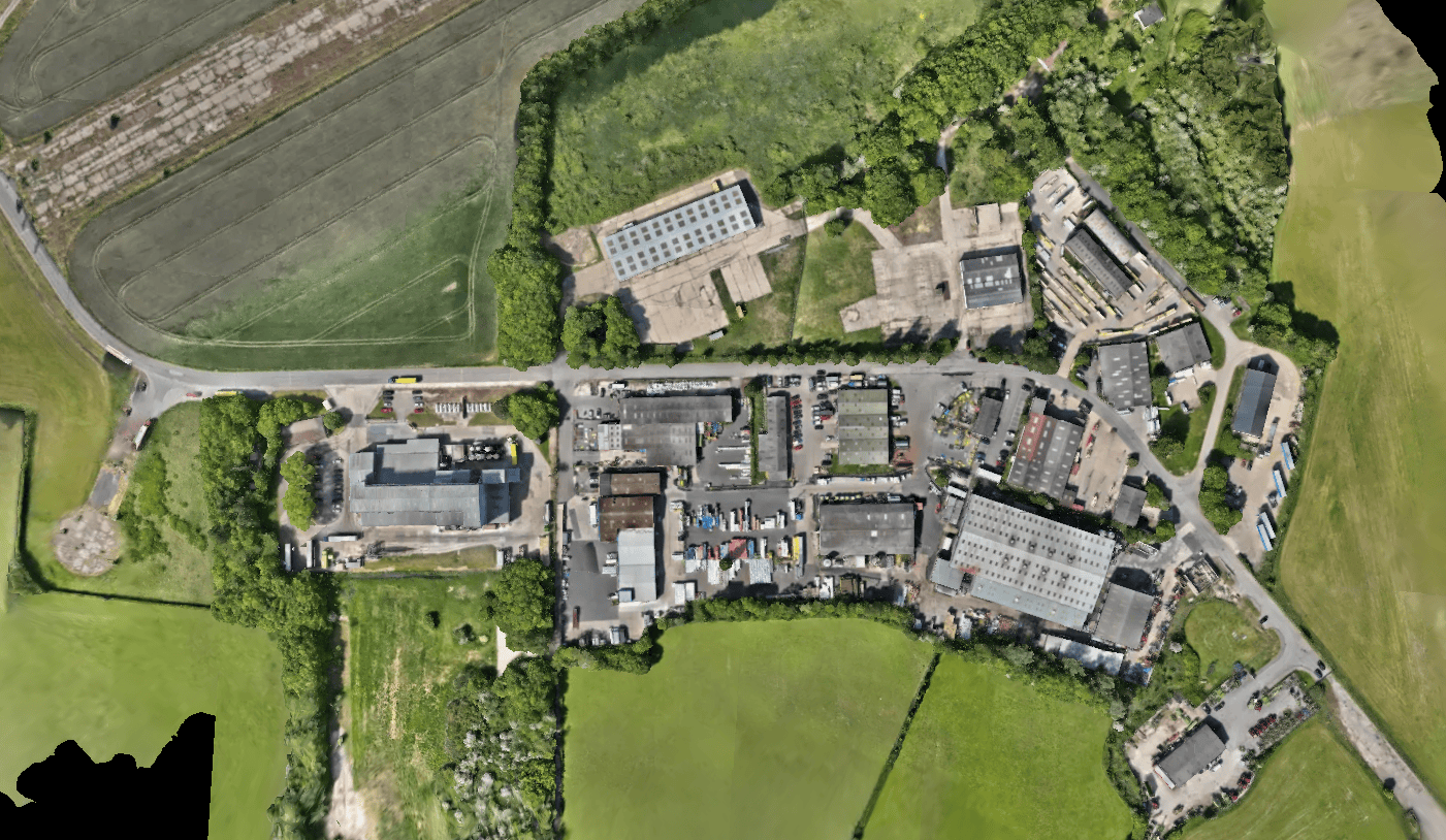
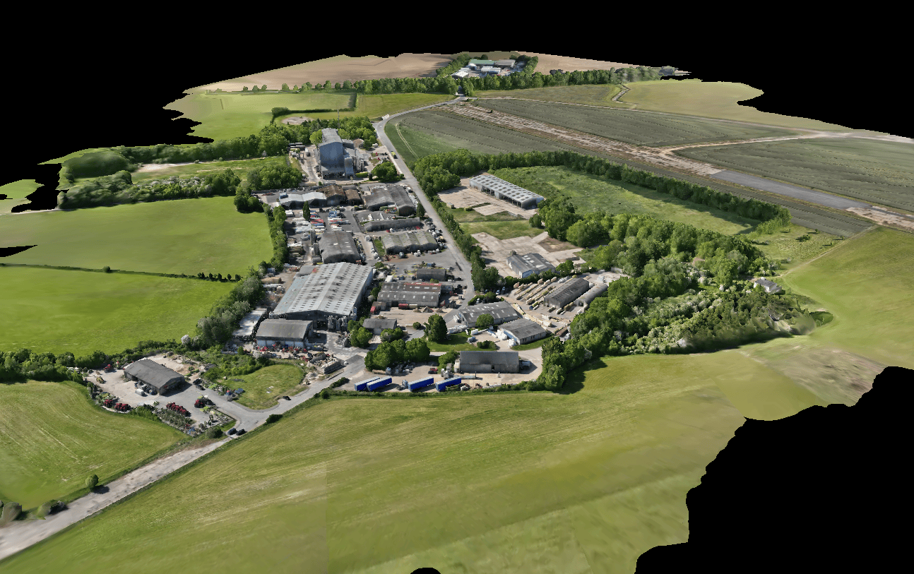
Industrial Estate — Redevelopment
Accurate site data including building footprints, access routes, and boundary positions for architects.
Customer Testimonial
"The beauty of RTK Data is that it is affordable and just as accurate if not more than some of the other ones I have tried that cost quite a bit more. It was very easy to setup and get the drone to connect to the service quickly. All of my customers have been very impressed by the RMSE of the final product and this is thanks to RTK Data."Bitu Williams — Founder & Business Owner, Sky Eye Imagery
Technical Setup
| Component | Detail |
|---|---|
| Correction Service | RTKdata NTRIP RTK |
| Protocol | NTRIP / RTCM 3.2 |
| Constellations | GPS, GLONASS, Galileo, BeiDou |
| Accuracy | 1-2 cm horizontal, 2-3 cm vertical |
| Drones | RTK-capable EO + thermal mapping drones |
| Deliverables | Orthomosaics, 3D models, point clouds, DEMs |
| Use Cases | Infrastructure mapping, demolition planning, planning disputes |
| Coverage | United Kingdom (RTKdata covers 140+ countries) |
What's Next
Sky Eye Imagery continues to expand its service offerings and client base across the UK. With RTK-corrected positioning as standard on every mapping mission, Bitu is building a reputation for deliverables that meet the accuracy requirements of architects, surveyors, and planning consultants.
The addition of thermal mapping capabilities opens further opportunities in building inspection, energy auditing, and infrastructure condition assessment — all areas where accurate georeferencing adds measurable value.
Frequently Asked Questions
Can RTKdata NTRIP corrections achieve survey-grade RMSE for photogrammetry?
Yes. Sky Eye Imagery consistently achieves 1-2 cm horizontal RMSE on photogrammetry deliverables using RTKdata's NTRIP RTK corrections, verified by professional architect and surveyor clients across the UK.
Does RTKdata work for drone mapping in the United Kingdom?
Yes. RTKdata provides full NTRIP RTK coverage across the UK with access to over 20,000 reference stations in 140+ countries. Sky Eye Imagery uses the service for commercial mapping projects throughout Buckinghamshire and beyond.
How does RTKdata compare in price to other UK RTK correction providers?
RTKdata is significantly more affordable than traditional UK correction services like OS Net or SmartNet, while delivering equal or better accuracy. Sky Eye Imagery's founder describes it as "affordable and just as accurate if not more than some of the other ones I have tried that cost quite a bit more."