
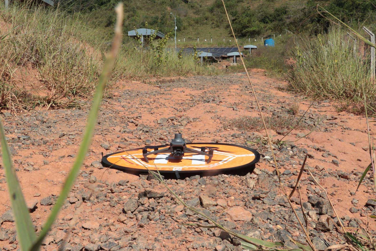
RTK for DJI Mavic 3T: Kira Solar Thermography Brazil
How Kira runs IEC-grade solar thermography on a $5,000 DJI Mavic 3T at 17 m altitude using RTKdata’s RTK network in Brazil. 3,192 modules indexed at Fortlev PoC.
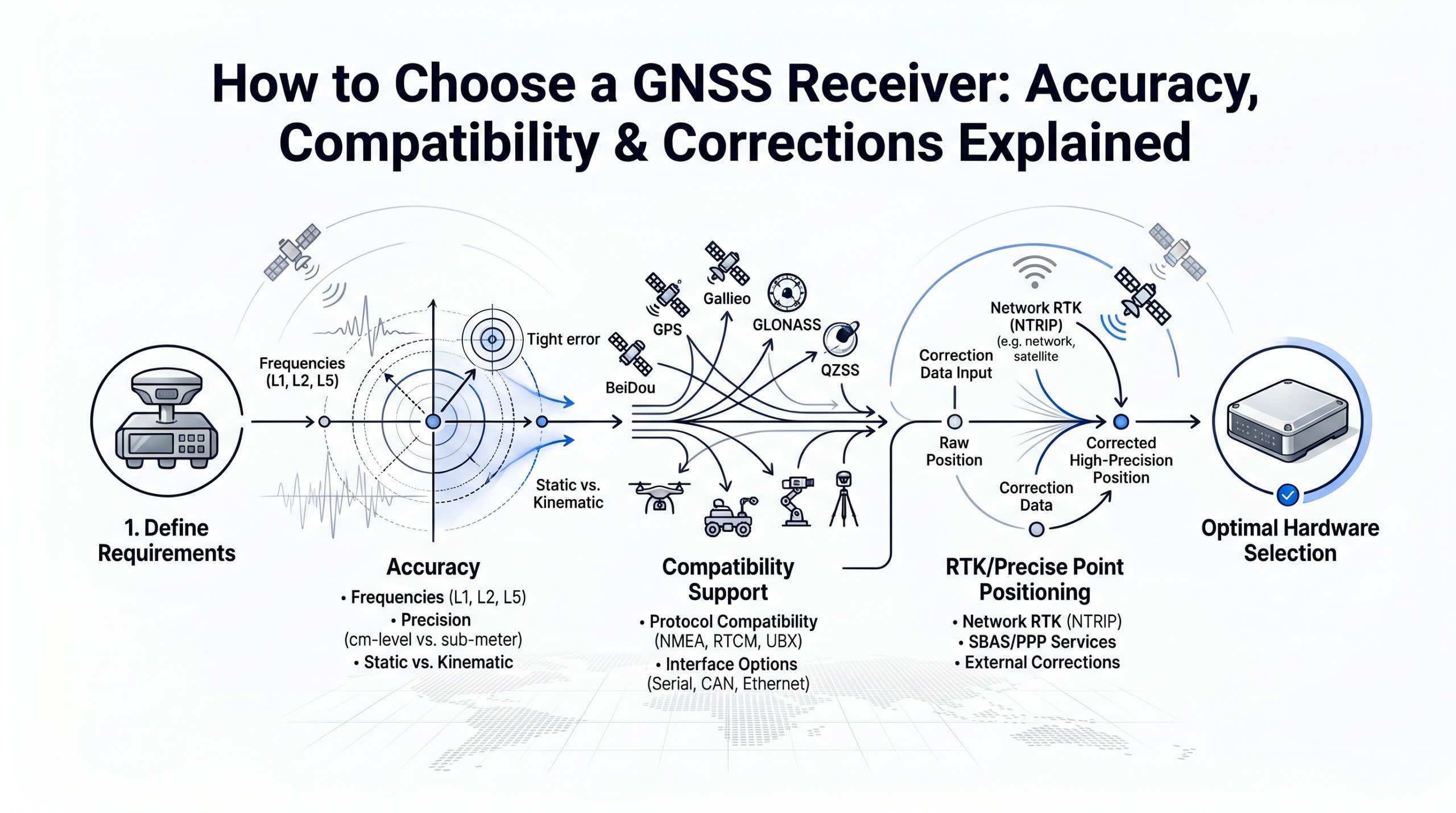
How to Choose a GNSS Receiver: Accuracy, Compatibility & Corrections
A complete buyer guide to GNSS receivers in 2026: frequency bands, RTK accuracy tiers, correction methods (cloud NTRIP vs base station), and a decision matrix for surveying, drones, and robotics.
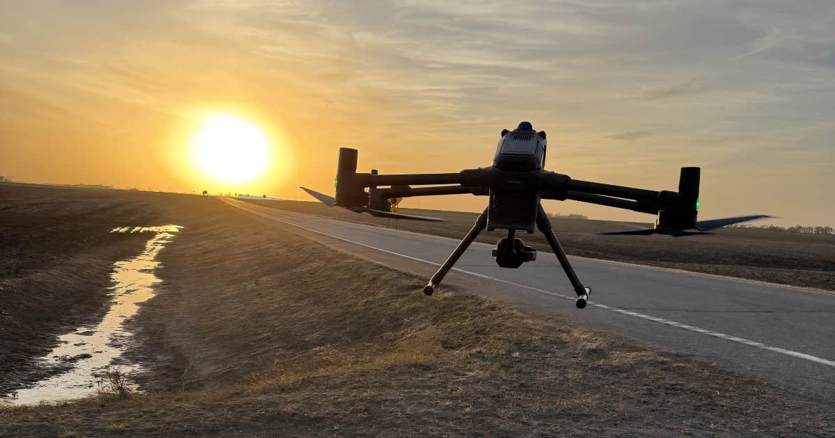
RTK GPS in Agricultural Drone Mapping: AeroAg’s South Dakota Fleet
How AeroAg Drone Services switched RTK providers in 10 minutes after a $37,500 downtime job, then flew a DJI Matrice 400 fleet across South Dakota, Minnesota, and North Dakota with RTKdata NTRIP corrections feeding the TerraClear rock-mapping pipeline.
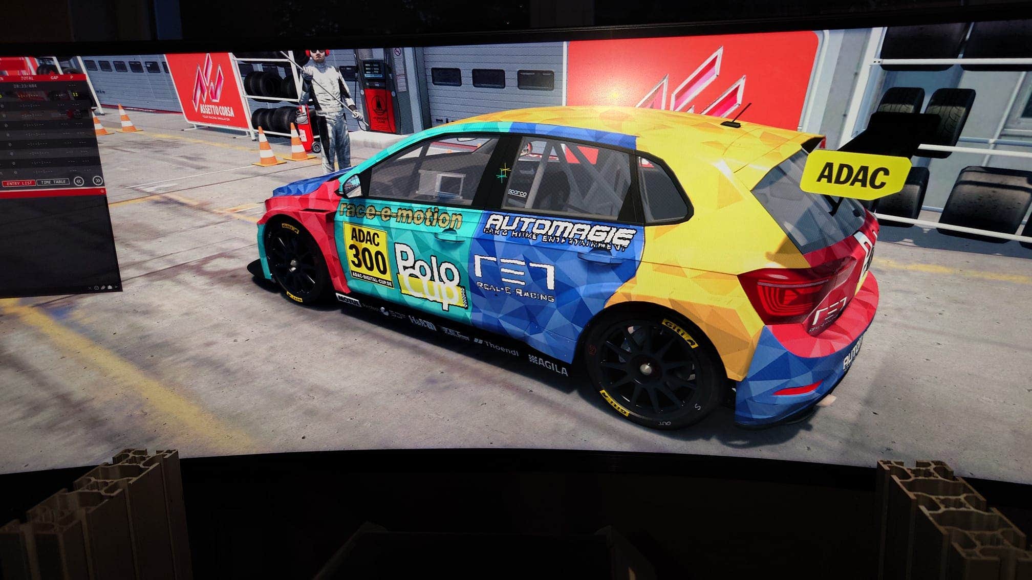
RTK GPS in Motorsport: Real-E-Racing’s Live Digital Twin
How Real-E-Racing replaces 2.5-meter OEM motorsport GPS with centimeter-accurate RTK GPS, building the first live digital twin of motorsport. Validated with a 1,000 km live stream from Silverstone to a sim rig in Stuttgart.

RTK GPS in Formula Student: PWR Racing’s RT16e Driverless
At 2-5 meters of standalone GNSS error, an autonomous Skidpad run is impossible. See how a Polish student team built a portable RTK stack for the RT16e Driverless car with RTKdata NTRIP and an XBee bridge, validated by tracing ‘OLEK’ on the GPS plot.
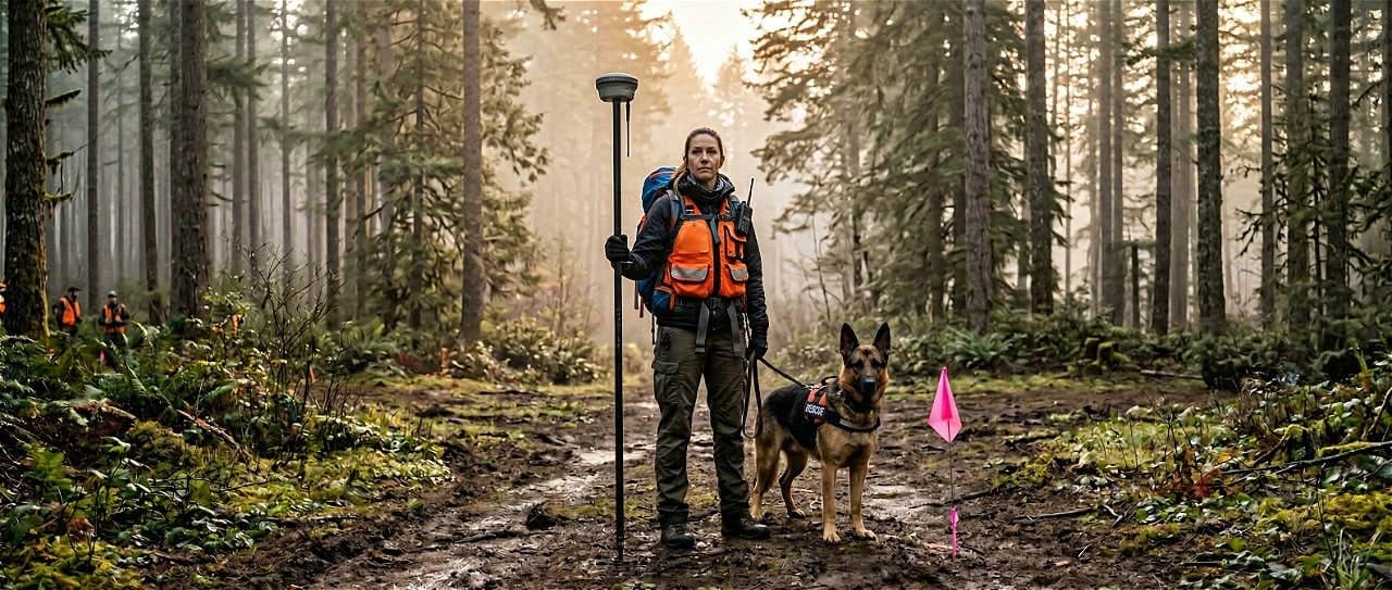
RTK GPS in Search and Rescue: How K9 Detection Teams Achieve Centimeter-Accurate Alert Locations
RTK GPS for search and rescue: K9 teams record cadaver dog alerts within centimeters, replacing handheld GPS off by 8-15 feet.
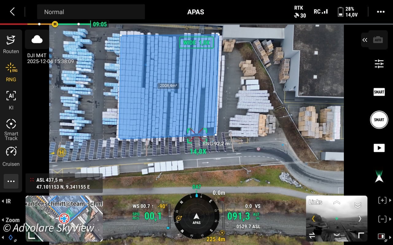
How ADVOLARE SkyView Achieves Centimeter-Accurate Drone Surveying in the Swiss Alps
ADVOLARE SkyView achieves centimeter-accurate drone surveying across the Swiss Alps using RTKdata’s NTRIP RTK corrections — replacing expensive regional networks for DJI Matrice 4T and 4DT missions.
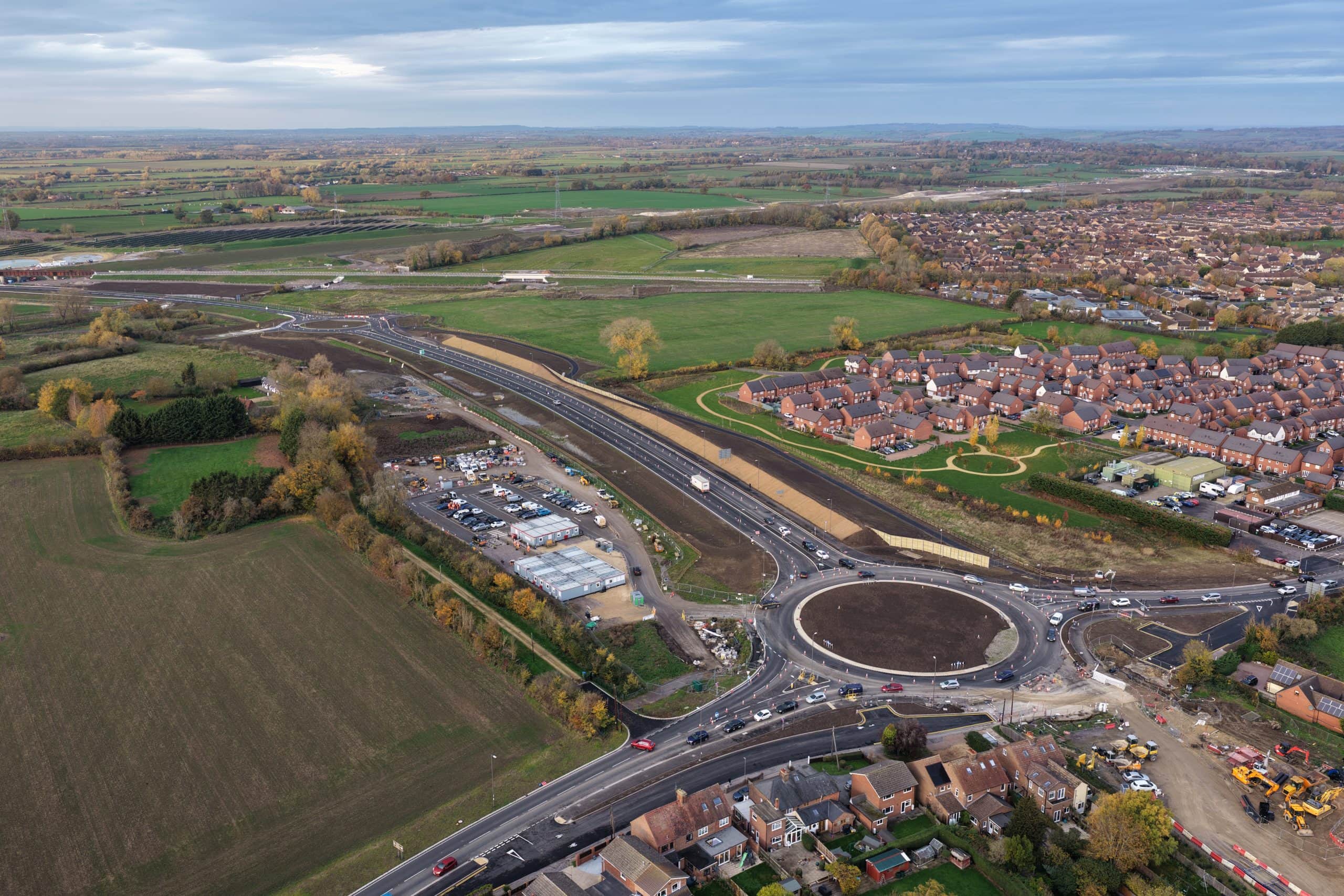
From RAF Veteran to RTK Drone Mapping Professional: How Sky Eye Imagery Delivers Centimeter-Accurate Surveys
Sky Eye Imagery delivers RTK drone mapping with 1-2 cm accuracy for UK infrastructure projects — using RTKdata’s NTRIP correction service at a fraction of previous costs.

RTK Survey Equipment: Parts, Corrections, Cost (2026)
RTK survey equipment delivers centimeter-level GNSS positioning using real-time corrections. This guide covers the complete parts list, base/rover vs Network RTK workflows, NTRIP setup, accuracy specs, and cost factors—including Kenya-specific buying guidance for 2026.