
RTK Corrections
for LiDAR Scanners
RTKdata delivers NTRIP corrections to compatible RTK-capable LiDAR configurations. The correct receiver, local coverage and an internet connection are required.
- 1-2 cm GNSS positioning for georeferenced scans
- 20,000+ RTK Stations in 140+ Countries
- No base station needed on site
- CHCNAV, XGRIDS, Stonex & other RTK-capable scanners
Start your free trial
What Does RTK Add to SLAM Scanning?
RTK adds absolute, real-world coordinates to SLAM scanning. SLAM measures geometry relative to the scanner’s own path, so a SLAM-only point cloud stays in local coordinates. With NTRIP corrections, an RTK-capable receiver records RTK positions along the scan trajectory, and the processing software uses those positions to georeference the whole point cloud.
Final point cloud quality still depends on the scanner, capture conditions and processing, and georeferenced outputs vary by model, software and license. The SLAM point cloud georeferencing guide covers processing; model settings are in the LiDAR scanner RTK setup guides.
NTRIP Service for LiDAR Scanners













LiDAR Scanner RTK Requirements
A LiDAR NTRIP connection needs suitable RTK hardware, a documented correction input and internet. The entry point may be the scanner, a separate rover, the payload or the aircraft.
LiDAR Scanners with Built-In RTK
CHCNAV RS10 / RS30 and XGRIDS K2 have integrated RTK receivers. Use the model’s NTRIP profile and required internet route.
Factory RTK Options for LiDAR Scanners
Eagle Standard / Max cannot gain RTK after shipping. Select the factory RTK option before shipping; a correction subscription cannot add missing hardware.
LiDAR Scanners with Retrofit RTK Modules
Raven / Raven Max and XGRIDS K1 need the matching RTK module. SHARE C1 / S20 SE also need a Positioning board kit. Check Raven module availability by region.
LiDAR Scanners with an External GNSS Rover
Hovermap Backpack / Vehicle uses a supported external rover and cable. Set up NTRIP on the rover, which supplies positions to Hovermap.
LiDAR Payloads with Their Own RTK Receiver
RTK-configured RESEPI / EchoONE payloads use their own GNSS receiver and internet connection. The NTRIP profile belongs in the payload web GUI.
LiDAR Payloads Using Aircraft RTK
Zenmuse L3 uses Matrice 400 RTK. Enter the service in DJI Pilot 2 on the controller; other aerial scanner routes have their own limits.
Check the RTK hardware for the exact scanner model before starting a correction trial. Use the LiDAR scanner RTK setup guides and check RTK coverage for your scanning location.
For an unclear configuration, share the scanner model, RTK variant and project location.
Connect a LiDAR Scanner to NTRIP Corrections
01
Activate a Free RTK Corrections Trial
02
Follow the Scanner's NTRIP Route
03
Check the Scanner's GNSS Solution
Reprojection options depend on the scanner, software and source / target coordinate systems; use the SLAM point cloud georeferencing guide.
RTK for LiDAR Scanning Without a Base Station
RTK LiDAR Scanning Applications
RTK supplies external GNSS position references for suitable LiDAR workflows across buildings, infrastructure, land and airborne mapping. The scanner’s capture and processing method determines how those references are used.
RTK LiDAR for BIM and Digital Twins
For exterior BIM and digital twin capture, RTK provides GNSS references for a compatible scan workflow. Indoor geometry remains dependent on SLAM and the scanner's processing method.
RTK LiDAR for Infrastructure Mapping
Infrastructure capture can use GNSS references to place scans within a project coordinate framework. Repeat visits still need a consistent reference system and independent checks.
RTK LiDAR for Agriculture and Forestry
Terrain and forestry workflows can use RTK where satellite reception is sufficient. Vegetation and GNSS obstruction require the scanner's capture strategy and result checks.
RTK Corrections for Airborne LiDAR Mapping
Airborne LiDAR uses either payload RTK or aircraft RTK, according to the documented configuration. See RTK corrections for drones for the broader aircraft context.
Combining RTK datasets requires consistent reference systems and compatible device / software processing; consult the SLAM point cloud georeferencing guide.
Which LiDAR RTK Setup Do You Have Today?
Once the scanner’s RTK route is confirmed, choose how to get corrections.
I use my own RTK base station
Check the subscription route against field internet and local coverage.
I already have an NTRIP subscription
Compare correction services at the project location using the scanner guide.
I need my first RTK correction subscription
Confirm RTK hardware before selecting a plan and stream count.
How to Get RTK Corrections for Your LiDAR Scanner
Path 1
NTRIP Subscription vs Your Own RTK Base Station
An NTRIP subscription can replace the own-base correction route when local coverage and field internet are suitable. An own base may be more practical when those conditions are unavailable.
| Requirement | Your own RTK base station | NTRIP subscription |
|---|---|---|
| Hardware | Compatible scanner RTK route plus base hardware | Compatible scanner RTK route remains necessary |
| Corrections | Own base setup and known base position | Online corrections where service coverage is suitable |
| Cost decision | Existing base equipment and operating setup | Subscription per simultaneous stream |
| Field condition | Suitable when an own-base route is available | Needs field internet and appropriate local coverage |
Compare the correction route using RTK coverage for your scanning location. For an airborne project’s broader method choice, read RTK and PPK for drone mapping.
Path 2
Switching an Existing NTRIP Subscription
Keep the existing subscription while comparing RTKdata at the project location. Use the model’s documented third-party NTRIP route to assess reception and GNSS behavior before changing services.
Profile storage and switching differ by device; follow the scanner guide for the supported procedure.
Path 3
Your First LiDAR RTK Corrections Subscription
Confirm the scanner’s RTK hardware, correction input, local coverage and internet route before choosing a first plan. Count the devices that will need corrections at the same time.
If RTK hardware is missing, return to the LiDAR scanner RTK requirements before starting a trial.
Compatible LiDAR Scanners and RTK Hardware
The documented setup routes below show the RTK hardware, NTRIP entry point and requirements for each scanner configuration. A shared manufacturer name does not make every variant RTK-ready.
Open the LiDAR scanner RTK setup guides for model settings. RTK positioning needs satellite reception; indoor capture follows the scanner’s SLAM workflow.
| Device and RTK variant | Type | RTK hardware | Setup guide |
|---|---|---|---|
| XGRIDS Lixel K1, K2, L2 Pro | Handheld; L2 Pro also mounts on drones | K2 built in; K1 RTK module and bracket; L2 Pro Standard RTK or Survey RTK module. | Open XGRIDS Guide |
| FJD Trion P1, P2, S2 series | Handheld | FJD RTK module (SR), with model-specific mounting. | Open FJDynamics Guide |
| CHCNAV RS10 / RS30 | Handheld | Built-in GNSS RTK. | Open CHCNAV Guide |
| 3DMakerpro Eagle, Raven, Hawk | Handheld | Eagle: factory option. Raven Max RTK: factory module. Raven / Raven Max: retrofit module. Hawk: RTK kit. | Open 3DMakerpro Guide |
| Stonex X200GO, X120GO, X70GO | Handheld; X200GO also mounts on drones | X200GO / X120GO V2 built in, with GNSS antenna / bracket; X70GO + RTK70 GO; X120GO V1 + RTK120 GO. | Open Stonex Guide |
| Emesent Hovermap ST / ST-X | Backpack or vehicle | External supported rover, Backpack RTK or Vehicle RTK kit and cable. | Open Emesent Guide |
| Inertial Labs RESEPI; Teledyne EchoONE | Drone payload; RESEPI also vehicle or backpack | Payload’s own GNSS / INS, configured for RTK. | Open Inertial Labs Guide |
| SHARE S20, C1 PRO, S100 | Handheld; S100 backpack | S20 / C1 PRO / S100 built in; S20 SE RTK detachable module; S20 SE / C1: module + Positioning board kit. | Open SHARE Guide |
| DJI Matrice 400 + Zenmuse L3 | Drone and LiDAR payload | Matrice 400 aircraft RTK; L3 has no separate NTRIP profile. | Open DJI Guide |
Full setup details for every scanner
| Device and RTK variant | RTK hardware | NTRIP entry point | Requirements | Setup guide |
|---|---|---|---|---|
| XGRIDS Lixel K1 (LixelKity K1), K2, L2 Pro Handheld; L2 Pro also mounts on drones | K2 built in; K1 RTK module and bracket; L2 Pro Standard RTK or Survey RTK module. | LixelGO RTK Settings. Aerial L2 Pro: aircraft RTK settings. | Phone or Wi-Fi internet required. Quick Connect needs phone mobile data; use Bridge Mode with an internet-connected Wi-Fi network when mobile data is unavailable. K2: LixelGO 2.0.1+. Quick Connect: firmware 3.1.1+; keep LixelGO open. Aerial correction delivery to L2 Pro remains unconfirmed. | Open XGRIDS Guide |
| XGRIDS Lixel L3, 16- and 32-channel versions Handheld | Built-in GNSS RTK, 16- or 32-channel L3. | LixelGO RTK Settings, following K2 / L2 Pro. | L3-specific screens are unpublished. NTRIP needs phone or Wi-Fi internet and LixelStudio processing. | Open XGRIDS Guide |
| FJD Trion P1, P2, S2, S2 PRO, S2 MAX Handheld | FJD RTK module (SR), with model-specific mounting. | Trion Scan RTK Settings, Ntrip profile. | Phone hotspot in network mode. P1 firmware V1.5+; iOS app 3.8.2+; P2 processing in Trion Model PC V207.001+. | Open FJDynamics Guide |
| CHCNAV RS10, 16 or 32 lines (32-line version sold as RS30) Handheld | Built-in GNSS RTK. | SmartGo Neo (Android), RTK settings, CORS. | Phone mobile data while connected to scanner Wi-Fi. CoPre required for RTK processing; follow the model-specific capture rules. | Open CHCNAV Guide |
| 3DMakerpro Eagle Standard / Max with factory RTK; Raven Max RTK; Raven / Raven Max with RTK module; Hawk with RTK kit Handheld | Eagle: factory option. Raven Max RTK: factory module. Raven / Raven Max: retrofit module. Hawk: RTK kit. | GPS screen on the scanner; Link Hotspots for internet. | Eagle cannot be retrofitted after shipping. Check Raven module availability by region. RayStudio Mobile has no NTRIP entry; no in-scan FIX indicator is documented. | Open 3DMakerpro Guide |
| Stonex X200GO, X120GO V2; X70GO with RTK70 GO; X120GO V1 with RTK120 GO Handheld; X200GO also mounts on drones | X200GO / X120GO V2 built in, with GNSS antenna / bracket; X70GO + RTK70 GO; X120GO V1 + RTK120 GO. | GOapp RTK Settings; module models: S-RTK / CORS. | Built-in models use a phone hotspot; modules use their own SIM. X200GO aerial correction delivery remains unconfirmed; M400 is described for PPK in the guide. | Open Stonex Guide |
| GreenValley LiGrip O2, O2 Lite (GNSS), SE RTK; O1 Lite, H300 / H300(B.00), H120 with RTK module; Topcon CR-S1; Sokkia SR-S1 / SR-S2 Handheld; H300 / H120 also use backpack, vehicle or drone kits | O2 / O2 Lite GNSS / SE RTK built in. O1 Lite / H300 / H120: module; H300 / H120 also mounting kit. | GreenValley app RTK link; Topcon / Sokkia: MAGNET Flow RTK Link. | Hotspot for integrated models; module SIM otherwise. LiDAR360MLS 9.0+: only H120(A.10) retains H120 SLAM. H300 discontinued; RTK-SLAM has regional limits. | Open GreenValley Guide |
| Emesent GX1 Backpack, survey pole, supported handheld and vehicle mounts | Built-in GNSS RTK and 4G modem. | Commander (Android), NTRIP profile. | Own data nano-SIM; WPA3 tablet. Commander 2.3.0 / Cortex 4.2.0 documented. Username limit: 20 characters. Confirm the Aura RTK-module license. | Open Emesent Guide |
| Emesent Hovermap ST / ST-X with Backpack RTK or Vehicle RTK Backpack or vehicle | External supported rover, Backpack RTK or Vehicle RTK kit and cable. | Rover: Emlid Flow, Trimble web interface or Leica Captivate; not Commander. | Supported: Emlid RS2 / RS2+ / RS3; Trimble R10 / R10-2 / R12 / R12i / R980; Leica GS18 / GS18T / GS18I. Trimble needs the NMEA option. RS4 / RS4 Pro are outside this setup. Check Cortex / Aura versions in the guide. | Open Emesent Guide |
| Inertial Labs RESEPI GEN-II (M2X-ILX / OS1-ILX), LITE, Ultra LITE; Teledyne EchoONE Drone payload; RESEPI also vehicle or backpack | Payload’s own GNSS / INS, configured for RTK. | Payload web GUI, RTCM corrections, NTRIP Client. | Confirm RTK configuration by serial number. Own internet via USB-LTE / SIM or documented Wi-Fi; aircraft RTK is not a substitute. PCMasterProGL processing; EchoONE 1.14.2+. | Open Inertial Labs Guide |
| GeoSun GS-100G, GS-130G, GS-200G (GS200) Handheld | Built-in GNSS RTK. | GeosunMeasure (Android), RTK Settings. | Phone internet; GS-100G / GS-130G connect by USB, GS-200G by Wi-Fi. Check PCC georeferencing against control points; real-time RTK handling is not fully documented. | Open GeoSun Guide |
| SkylandX MetaCam Air 2, MetaCam Air (first generation) Handheld | Built-in RTK on Air 2 and first-generation Air. | MetaCam Go, RTK Account. | Phone internet; iPhone Wi-Fi requires the guide’s manual configuration. MetaCam Studio needs a USB dongle; RTK optimizer requires RTK capture. PPK is not documented for these Air models. | Open SkylandX Guide |
| SHARE S20, C1 PRO, S20 SE RTK; S20 SE / C1 with RTK kit; S100-16 / S100-32 / S100-32 PRO Handheld; S100 backpack | S20 / C1 PRO / S100 built in; S20 SE RTK detachable module; S20 SE / C1: module + Positioning board kit. | SHARE Capture, RTK / Edit Account, User-Defined. | Phone internet. C1 PRO steps follow S20. RTK may be restricted outside the sales region. SHARE PointClouds Studio required for RTK processing. | Open SHARE Guide |
| DJI Matrice 400 with Zenmuse L3 Drone and LiDAR payload | Matrice 400 aircraft RTK; L3 has no separate NTRIP profile. | DJI Pilot 2 on the remote controller, aircraft RTK settings. | Controller internet required. Some profile fields follow other DJI models and may differ. DJI Terra 5.3.0+ for L3 processing. The configuration does not establish support for other payloads. | Open DJI Guide |
For unclear hardware, regional restrictions or software requirements, Contact Us with the exact model and scanning location. Processing, reference systems and heights are covered in the SLAM point cloud georeferencing guide.
Free Trial of NTRIP Corrections for LiDAR
Try corrections for 30 days without a credit card. The trial ends automatically; first confirm the scanner’s RTK configuration and local coverage.
LiDAR GNSS Accuracy and RTK Service Facts
RTKdata’s 1-2 cm horizontal and 2-3 cm vertical accuracy refers to GNSS positioning under RTK FIX and suitable conditions. Final LiDAR point cloud accuracy also depends on sensors, the scan trajectory and processing.
RTK uses real-time corrections; PPK applies corrections after capture. RTK does not replace independent quality checks, and control points may still be needed for the chosen GNSS / scanning workflow; see the SLAM point cloud georeferencing guide.
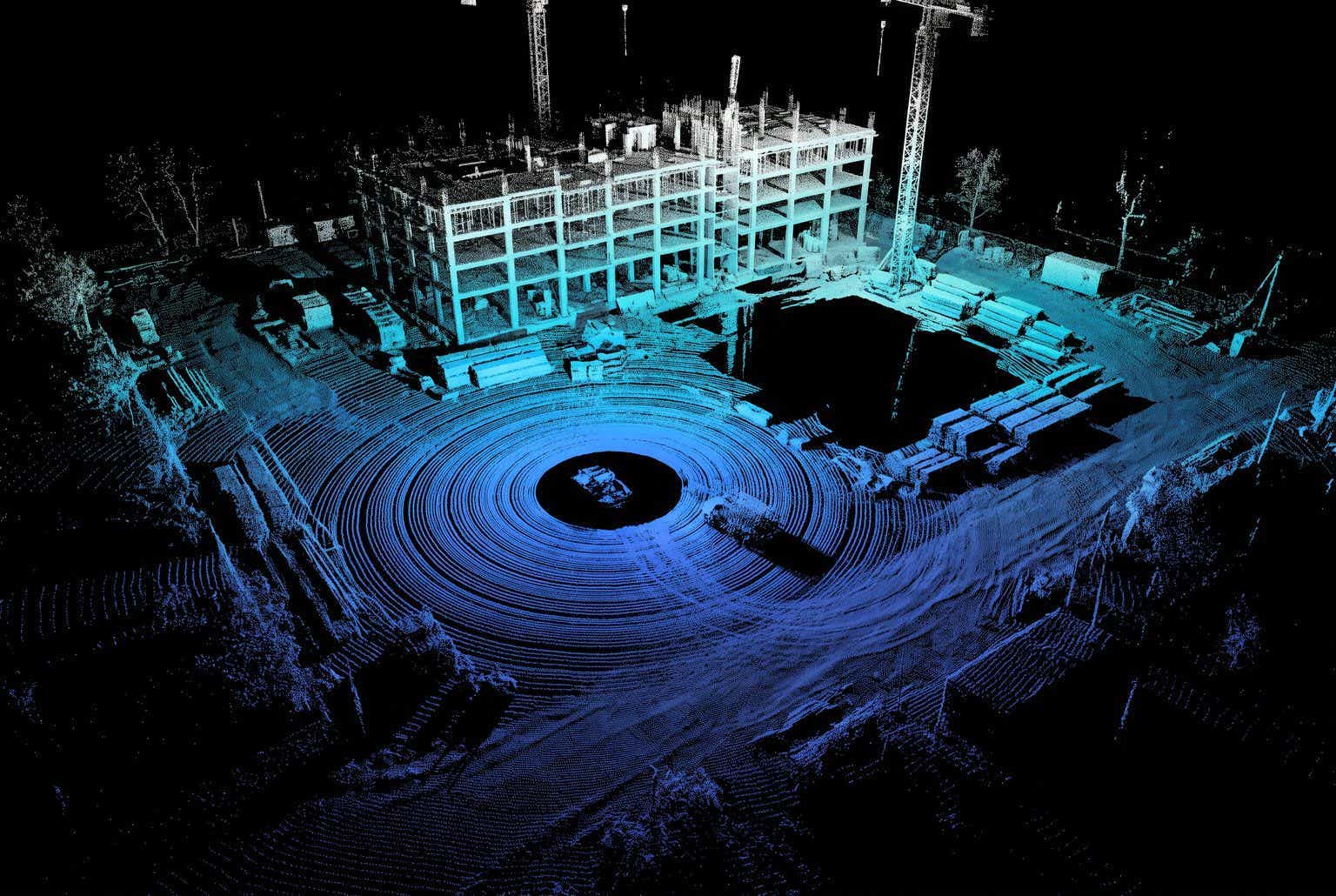
Confirm the scanner's RTK route, internet and local coverage. RTK improves GNSS positioning; the finished point cloud needs its own quality checks.