

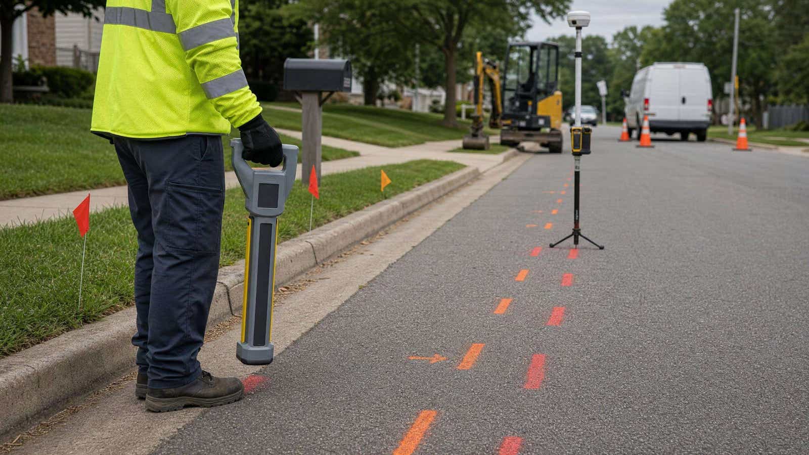
TL;DR An underground utility locator tells you a buried line is under your feet. Electromagnetic (EM) locators trace conductive pipes and cables through a signal; GPR images the ground and also finds plastic, but loses depth in wet clay. But few record that point to survey grade in a coordinate system, which is the gap RTK corrections close.
Picking the right underground utility locator matters because a utility strike is a daily event. The Common Ground Alliance models 668,999 damages to US buried utilities in 2025, more than one a minute, at an estimated $83.2 billion a year (CGA economic impact report, August 2026). Below are seven tools from a $126 wire tracer to a radar cart, with published depth ratings and prices, plus what locating alone still misses.
What Is an Underground Utility Locator?
An underground utility locator finds buried pipes and cables before anyone digs. Most utility locating equipment is built for electromagnetic utility locating: a receiver reads the magnetic field around a conductive line. A transmitter puts a known active frequency on that line, while a receiver in passive mode picks up fields already there, such as 50/60 Hz power or radio. Vivax-Metrotech's training guide uses passive mode for avoidance sweeps and active mode for tracing and depth estimation (The Theory of Pipe and Cable Locating).
The second family is ground penetrating radar, which records radio-pulse reflections from metal and non-metal alike. Many crews carry both kinds of utility locating equipment: EM for the daily trace, GPR when the target may be plastic.
Public vs Private Utility Locating: What 811 Does Not Cover
In the US, 811 is the free call before you dig service, and the national 811 site says you must contact it a few days before any digging (811beforeyoudig.com). Member utilities then send locators to mark their lines with paint or flags.
But the request has an edge. South Carolina's one-call center says standard locating services "only mark public utility lines that run from the street to your property's main meter"; lines beyond it are private, and the owner must identify them (SC811 FAQ). Propane lines, sewer laterals, feeds to lamp posts and sprinklers, for example, all fall on that side (Diggers Hotline). That is why contractors and private locating firms own an underground utility locator: on the customer side of the meter, nobody else marks the line.
How We Chose These Locators
We did not field-test these units, so we built the list from manufacturer data with four rules:
- Current product. Each model is on its manufacturer's site. Amprobe points AT-3500 buyers to the UAT-620, its updated version, so we list the UAT-620.
- Published specifications. Depth, frequency and weight come from maker pages or datasheets; sources date from October 2026. Missing figures are marked as such.
- Full price range. From a sub-$200 tracer to professional underground locating equipment and GPR, priced from dealer listings.
- Data output. We note which utility locator tool models log a position, because that decides how a locate becomes a record.
Underground Utility Locators at a Glance
| Device | Method | Max Depth | Best For | Approx. Price (Oct 2026) |
|---|---|---|---|---|
| Noyafa NF-826 | EM, direct connection | 3.3 ft (1 m); 8.2 ft (2.5 m) on a loop | Shallow wire tracing | $126 to $160 |
| Leica DD120 | EM, power, radio, transmitter | 10 ft (3 m) | Construction crews | $1,620; $3,018 Depth Package |
| RIDGID SeekTech SR-20 | EM, line trace and sonde | Not published | Plumbing and sewer | $3,392; $5,483 kit |
| Amprobe UAT-620 | EM, 8/33 kHz kit | 20 ft (6 m) | Electrical contractors | $7,186 list |
| Radiodetection RD8200 | EM, 21 active frequencies | 98 ft (30 m) readout | Utility locating firms | $8,248 kit |
| Vivax-Metrotech vLoc3-Pro | EM, 98 Hz to 200 kHz | 98 ft (30 m) readout | Locates that feed GIS | $3,290; $5,340 kit |
| GSSI UtilityScan | GPR, 350 MHz | 35 ft (10 m) | Non-conductive pipes | Dealer quote |
"Readout" is the deepest value the receiver can display, while real depth depends on signal strength and ground conditions.
Best Underground Utility Locators in 2026
Noyafa NF-826 - Best for Shallow Wire Tracing
A budget underground wire locator and in-wall circuit tracer.
- Method: EM, direct connection to the wire.
- Depth: about 1 m (3.3 ft); up to 2.5 m (8.2 ft) in single-loop mode.
- Frequency: 125 kHz.
- Energised/de-energised: clips to dead or live wire (CAT III 300 V); detects live mains to about 0.4 m.
- Weight: 235 g (8.3 oz) per unit.
- Transmitter included: yes.
- Approx. price: $126 sale, $160 list (Noyafa store, Oct 2026).
It traces known low-voltage runs, such as landscape lighting. Unlike passive-sweep models, it cannot search for unknown lines. Specs: NF-826 manual.
Leica DD120 - Best for Construction Crews
A Leica Geosystems underground cable locator with automatic pinpointing.
- Method: EM; Power, Radio and transmitter modes.
- Depth: 1 to 10 ft (0.3 to 3 m) for line and sonde.
- Frequency: 50 or 60 Hz power; 15 to 60 kHz radio; 8 and 33 kHz with a DA220 transmitter.
- Energised/de-energised: both; Radio mode finds some dead lines, the transmitter gives depth.
- Weight: 5.95 lb (2.7 kg).
- Transmitter included: no, sold as a package.
- Approx. price: $1,620 receiver, $3,018 Depth Package with DA220 (Leica shop, Oct 2026).
Minimal training buys a usable avoidance sweep. Its limits, however, are the 3 m depth-reading ceiling and IP54 sealing. Specs: Leica DD120.
RIDGID SeekTech SR-20 - Best for Plumbing and Sewer
RIDGID's lightweight utility line locator for line tracing and sondes.
- Method: EM line trace, passive trace and sonde.
- Depth: continuous measured depth; RIDGID publishes no maximum.
- Frequency: active 128 Hz to 33 kHz; passive 50/60 Hz; sonde 16 Hz to 33 kHz; user frequencies from 10 Hz to 35 kHz.
- Energised/de-energised: both, with the ST-305 transmitter for de-energised lines.
- Weight: 3.5 lb (1.6 kg).
- Transmitter included: only in kits such as 46918.
- Approx. price: $3,392 receiver, $5,483 kit (dealers, Oct 2026).
It excels at following a sonde on a duct rodder through a non-conductive drain. Specs: RIDGID SR-20.
Amprobe UAT-620 - Best for Electrical Contractors
Amprobe's underground cable locator kit and the updated version of its AT-3500.
- Method: EM; passive power and radio, plus induction, direct connection and clamp.
- Depth: up to 20 ft (6 m).
- Frequency: 8 and 33 kHz active; 50/60 Hz passive.
- Energised/de-energised: both; CAT IV 600 V rated for direct connection to live lines.
- Weight: receiver 4.2 lb (1.9 kg), transmitter 7.0 lb (3.2 kg).
- Transmitter included: yes, plus signal clamp.
- Approx. price: $7,186 list (TEquipment, Oct 2026).
Two active frequencies leave fewer choices when the signal bleeds onto adjacent lines. Specs: Amprobe UAT-620.
Radiodetection RD8200 - Best for Utility Locating Firms
A multi-frequency pipe and cable locator with optional built-in GPS (RD8200G).
- Method: EM; passive Power, Radio and CPS plus active locate.
- Depth: readout to 98 ft (30 m) for cable and pipe, 64 ft (19.5 m) for sondes.
- Frequency: 21 active frequencies from 98/128 Hz to 200 kHz.
- Energised/de-energised: both.
- Weight: 4.0 lb (1.8 kg) with Li-ion pack.
- Transmitter included: sold separately or in kits.
- Approx. price: $8,248 locator kit (US dealer, Oct 2026).
It especially suits crews who need many frequencies and logged points. However, its internal GPS is rated at 2.5 m CEP. Specs: RD8200 specification.
Vivax-Metrotech vLoc3-Pro - Best for Locates That Feed GIS
A color-screen EM receiver with distortion warnings, internal logging and Bluetooth.
- Method: EM; eight passive modes plus active locate and sonde.
- Depth: readout to 98 ft (30 m), depending on signal.
- Frequency: configurable from 98 Hz to 200 kHz.
- Energised/de-energised: both.
- Weight: 4.6 lb (2.1 kg).
- Transmitter included: no; sold in kits with Loc3 5 W or 10 W units.
- Approx. price: $3,290 receiver, $5,340 with 5 W transmitter (US dealer, Oct 2026).
Each log stores depth, current, frequency and position, but position is only as good as the paired GNSS. The vLoc3 RTK-Pro, however, adds built-in RTK. Specs: vLoc3-Pro.
GSSI UtilityScan - Best for Non-Conductive Pipes
A GPR cart built for utility locating.
- Method: GPR.
- Depth: up to 35 ft (10 m), soil dependent.
- Frequency: 350 MHz antenna.
- Energised/de-energised: not relevant.
- Weight: 37 lb (16.8 kg) with tablet and battery.
- Transmitter included: not needed.
- Approx. price: dealer quote only.
It finds PVC with no tracer wire or sonde, which EM tools cannot. However, conductive clay cuts its depth sharply. Specs: GSSI UtilityScan.
EM vs GPR: Which Method Finds What
Which underground utility locator you need depends on the target. EM needs a conductive line, or a conductor added to it, plus an access point for a direct connection or clamp. GPR needs no access and no metal, but it needs cooperative soil.
When Electromagnetic Locating Wins
Electromagnetic utility locating wins on metallic pipes, power and telecom cables, and plastic lines with tracer wire. An underground cable locator works best on a direct connection; inductive coupling needs no access but "may couple to other metallic lines", in Vivax-Metrotech's words. The Common Ground Alliance notes that non-conductive materials such as PVC "cannot be located using traditional locate methods" without a tracer wire or marker (CGA Best Practice 2-17). A tracer wire locator follows the wire, so a broken wire means a lost line.
When Ground Penetrating Radar Wins
GPR wins on PVC, clay and concrete pipe and lines with no access point. But it fails in wet clay. The USDA's soil service says high conductivity "rapidly" decreases radar energy, that conductivity rises with water, clay and salt, and that well drained sandy soils suit deep profiling (NRCS). So in wet clay, expect a shallow scan and confirm by potholing, vacuum excavation or daylighting.
For more on each method, see our guide to underground utility locating methods.
Marking Is Not Mapping: Where Locating Workflows Break
Every underground utility locator on this list answers one question: is a line here, under my feet? None answers, to survey grade, where "here" is in a coordinate system. A utility locator tool reports offset, depth and signal relative to itself; positioning the mark precisely is someone else's job.
The Two-Visit Problem
The usual workflow runs in two passes. The locate tech paints the line. Later, a survey crew records the marks, if the paint survives traffic, rain and mowing. So the as-built record is only as good as its weakest visit. Logging utility locating equipment shortens this, but its GPS is not survey grade: Radiodetection rates the RD8200G's at 2.5 m CEP. State laws generally keep mechanized equipment 18 to 24 inches from a marked line on all sides, the tolerance zone (811 for professionals). A 2.5 m CEP is several times wider than that zone, so a logged point can land outside the area it is meant to protect.
Adding RTK Corrections to a Locating Workflow
RTK corrections close that gap in one pass: the coordinate is captured at the moment of the locate. Several workflows also use NTRIP corrections. The vLoc3 RTK-Pro has built-in RTK GNSS rated at 0.01 m + 1 ppm CEP and its own LTE modem (specification). The RD8200 reads position from an external GNSS receiver over Bluetooth, and GSSI shows UtilityScan maps collected with NTRIP-corrected positions. The Subsite UtiliGuard 2 RTK takes corrections through the MyUtiliGuard app; see our setup guide.
RTKdata streams RTCM3 corrections over NTRIP from 20,000+ reference stations in 140+ countries. Our documentation describes 2 cm survey-grade accuracy in the 2 cm zone of the coverage map and 2 to 10 cm horizontal elsewhere, with the best results within 15 km of a base station (accuracy expectations). That is centimeter accuracy against meters for standalone GNSS, as our RTK vs GPS accuracy comparison shows. Then check our network coverage for your area, and see RTK for utilities and RTK for surveying. To test it on your locates, start a free 30-day trial. Damage prevention starts with the locate, but the record keeps it working.
FAQ
Which detector is used to detect underground utilities?
Most crews use an electromagnetic underground utility locator: a receiver paired with a transmitter that puts a signal on metallic pipes, cables or tracer wire. Ground penetrating radar is the second detector, used for PVC, clay and concrete lines that carry no signal. For shallow cables alone, however, a basic underground wire locator is often enough.
What is a utility locator?
A utility locator is an instrument that detects buried pipes and cables before digging. Most are electromagnetic receivers paired with a transmitter; GPR units are the other main type. The term also describes the technician who runs the locate.
What is the best underground locator for finding buried utilities?
It depends on the target. For mixed metallic utilities, a multi-frequency utility line locator with a transmitter, such as the Radiodetection RD8200 or Vivax-Metrotech vLoc3-Pro, covers the most ground. For PVC or other non-conductive lines without tracer wire, add a GPR unit such as the GSSI UtilityScan.
What method is most common for locating underground pipes?
Electromagnetic locating. A transmitter puts a signal on the pipe by direct connection, clamp or induction, and the receiver traces it. Plastic pipe without tracer wire, however, needs a sonde on a duct rodder, or GPR.
Does 811 locate private utilities?
No. 811 requests reach member utilities, which mark public lines up to the meter. Lines beyond the meter, such as sprinkler feeds or sewer laterals, are private; the property owner must have them located, usually by a private locating service.

Leads marketing, growth, and customer-facing communication at RTKdata and builds the demand engine across paid, content, and outreach.