

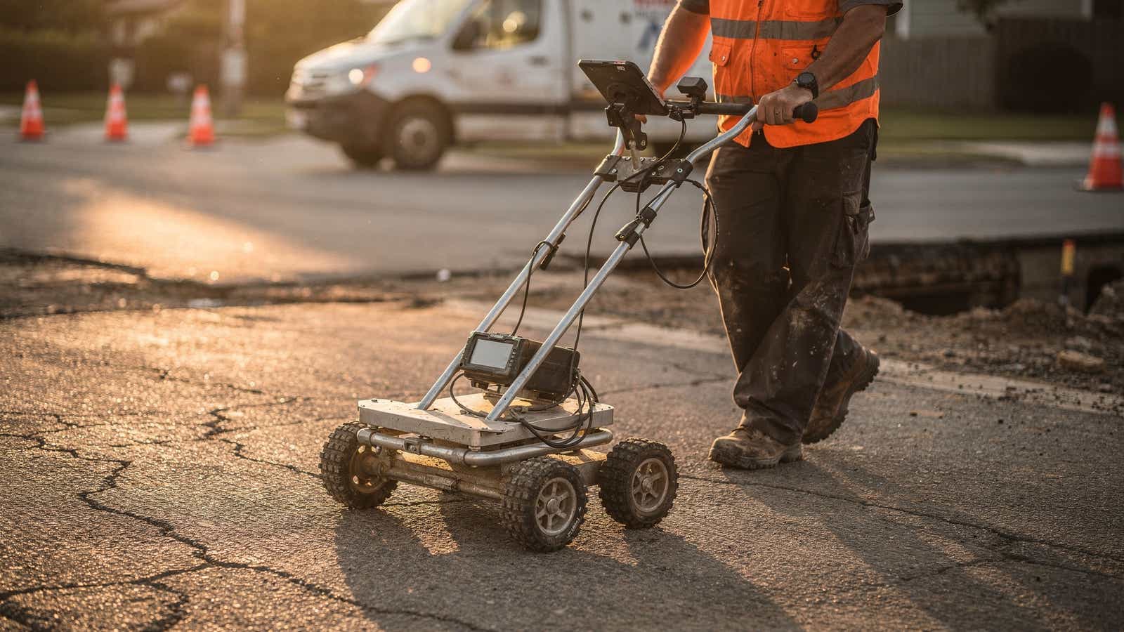
Underground utility locators stand between an excavator bucket and a live gas main. Crews that locate underground utilities properly hand over a map. Crews that do not hand over an incident report. The Common Ground Alliance prices damage to buried US utilities at $83.2 billion a year. This guide covers the three detection methods, where each stops being reliable, and how RTK GPS corrections turn a detected line into a survey-grade record.
What is underground utility locating? It is the process of detecting, tracing and recording buried pipes and cables before excavation starts, using electromagnetic induction, ground-penetrating radar and physical verification, each returning a different level of confidence.
- Buried utility damage costs the US economy $83.2 billion a year, $16 of indirect loss per $1 of repair.
- One-call tickets mark public mains only, so private laterals carry the surprises.
- EM traces conductive lines, GPR finds plastic pipe, vacuum excavation confirms by exposing.
- Detection is relative to the operator. RTK GNSS puts the line on Earth at roughly 2 cm.
- RTK on the GPR cart merges detect and map into one pass.
Why Underground Utility Locating Still Causes Costly Mistakes
The Common Ground Alliance modelled 668,999 damage incidents in the United States in 2025 and priced the fallout at $83.2 billion a year. The structure matters more than the total: for every dollar of repair, nearly $16 is lost to business interruption, emergency response and schedule slip (Common Ground Alliance, August 2026, retrieved August 2026).
Record quality is the root of it, because desktop utility searches return as-built drawings sketched from memory and never updated. Underground utility locators trust the drawing and mark a line that moved 3 m in 1987, and the project absorbs construction excavation accuracy costs it never budgeted for.
Paint is the second problem, since it fades in a fortnight and precision positioning stops being optional six weeks later.
Public vs Private Utility Locating
The distinction decides who is liable. A one-call ticket, dialled through 811 in the United States, obliges member facility owners to mark their public mains free of charge, but coverage stops at the meter.
Everything past it is private. Irrigation feeds, site lighting, fibre between buildings and sub-metered power sit outside the one-call scheme, so nobody marks them. Private locates are contracted work, carried out by underground utility locators who bill for the survey.
Teams locating underground services in the UK and EU deliver a graded product rather than a paint line. BSI PAS 128 grades each mapped service, from QL-D (desktop utility searches of records) up to QL-A, physically exposed and surveyed in place.
The Three Main Detection Methods
Three underground utility locating methods carry almost all commercial field work, and they are complementary rather than competing. A serious utility mapping survey uses all three in sequence to locate underground utilities and verify what matters.
An FHWA-commissioned Purdue University study of 71 highway projects worth over $1 billion found $4.62 in savings per $1.00 spent on subsurface utility engineering (FHWA, December 1999, retrieved August 2026).
Electromagnetic (EM) Locators
An EM locator couples a signal onto a conductive line and tracks the field it radiates. It traces metallic pipe, cable and tracer wire fastest, so most underground utility locators start every job with one.
The limits are physical. EM needs a conductor, so plastic pipe without tracer wire is invisible, congested corridors bleed signal between parallel lines, and depth is calculated rather than measured.
Ground-Penetrating Radar (GPR)
GPR reads reflections from anything with a contrasting dielectric constant, which covers what EM cannot see: PVC and HDPE pipe, clay drains, vaults and voids.
Soil sets the ceiling. Dry sand lets a 400 MHz antenna reach several metres, while wet clay cuts usable depth to under a metre. Interpretation is a skill, since a hyperbola on the radargram is a reflector, not a labelled pipe.
Vacuum Excavation and Potholing
Vacuum excavation, also called potholing or daylighting, uses pressurised air or water to break up soil and a vacuum to lift the spoil, exposing the utility without touching it. It is the only method that turns a probable line into a confirmed one, with true depth measured.
The cost is throughput, so potholing is applied selectively at crossings and tie-ins.
How RTK GPS Raises the Accuracy Bar
Detection is a local answer: where is the line relative to the operator. Mapping is a global one, in the coordinate system the design team, the GIS and machine control share. The US government commits to a daily average user range error of 2.0 m or better and notes that augmentation enables "real-time positioning within a few centimeters" (GPS.gov, retrieved August 2026).
RTK is that augmentation. A reference station on a known point watches the same satellites your rover sees, computes each signal's error, and sends the difference to the receiver, which resolves carrier phase near 2 cm. It is the physics behind survey-grade RTK corrections in land surveying, set out in how RTK reaches centimeter accuracy.
Delivery runs over NTRIP, which streams RTCM corrections on mobile data. No tripod, no radio licence, no second person on site. Underground utility locators get the centimeter-level positioning a survey crew uses, from a subscription and a SIM. Baseline length is the main variable, and accuracy degrades as it grows.
Combining RTK with GPR
Mount a GNSS antenna on the GPR cart, feed it corrected positions, and every scan line is geotagged as soon as it is collected. Crews that locate underground utilities detect and map in one pass, instead of one team marking ground and another returning for the marks.
The deliverable changes with it. Instead of paint that survives one rain event, the output is a georeferenced line in the project CRS, ready for GIS, CAD or machine control, and the second mobilisation never happens.
Correction quality is the constraint. Under open sky most rovers on the RTKdata network reach RTK FIX in 5 to 20 seconds, across 20,000+ reference stations. Utility corridors run along building faces and under canopy, where multipath drops a fix, so log fix status with every point. The same discipline governs RTK corrections for utilities captured from drone-mounted sensors.
When desktop utility searches, EM traces and GPR scans land in one georeferenced layer, conflicts surface before the excavator is booked.
What to Look for in Utility Locating Equipment in 2026
- Multi-constellation, multi-band GNSS. GPS, GLONASS, Galileo and BeiDou with L1/L2/L5 tracking. Multi-constellation support holds a fix where buildings mask half the sky.
- An open NTRIP client. Some receivers take corrections only from the manufacturer's own service, so choosing a GNSS receiver turns on this more than on headline accuracy.
- Fix status in every logged point. Fixed, float and autonomous belong in the field app and the export.
- A measured antenna offset. A guessed offset shifts every point by the same error.
Regional routing matters too, since latency is part of the accuracy budget.
| Region | NTRIP host | Port | Mountpoint |
|---|---|---|---|
| Europe | eu.rtkdata.com | 2101 | AUTO |
| North America | rtk.rtkdata.com | 2101 | AUTO |
| Australia | aus.rtkdata.com | 2101 | AUTO |
Underground utility locators should test hardware on the corridor itself, since a receiver that holds fix in an open field and loses it against a terrace has told you nothing. The same question arises for positioning on ground robots, where the gap between RTK and standard GPS shows fastest.
FAQ
How accurate are underground utility locators?
EM and GPR place lines within tens of centimetres, depending on soil, depth and congestion. Depth is calculated, not measured, so only vacuum excavation confirms it.
Can ground-penetrating radar find plastic pipes?
Yes. GPR responds to dielectric contrast rather than conductivity, so PVC, HDPE and clay pipe are detectable when the soil lets the pulse through. Wet clay cuts usable depth.
Why do utility locating crews use RTK GPS?
Detection finds a line relative to the operator. RTK GNSS records it near 2 cm in the project coordinate system, so the result is a permanent asset, not paint.
Do I need a base station to run RTK on a locating cart?
No. An NTRIP subscription streams RTCM corrections over mobile data, so the rover needs a SIM and credentials, not a tripod and a second receiver.
How long does an RTK fix take in the field?
Under open sky most rovers reach a fixed solution within 5 to 20 seconds, but obstructed sky view, high latency and long baselines can hold it in float.
Put Corrections on Your Locating Rig
Detection hardware finds the line, but the corrections layer decides whether the record you hand over is worth 2 cm or 2 metres.

Leads marketing, growth, and customer-facing communication at RTKdata and builds the demand engine across paid, content, and outreach.