

RTK vs GPS: Understanding Accuracy, Corrections, and Workflow Differences in 2026
Most “GPS” in the field is uncorrected GNSS (SPP) and often sits around 1–5 m—fine for navigation, costly for staking and QA. RTK adds RTCM corrections (usually via NTRIP) and carrier-phase to deliver centimeter-level positioning when you maintain an RTK FIX, and shows when PPK or PPP is the smarter workflow.
How Precision Farming Works: RTK Accuracy & Real Workflow
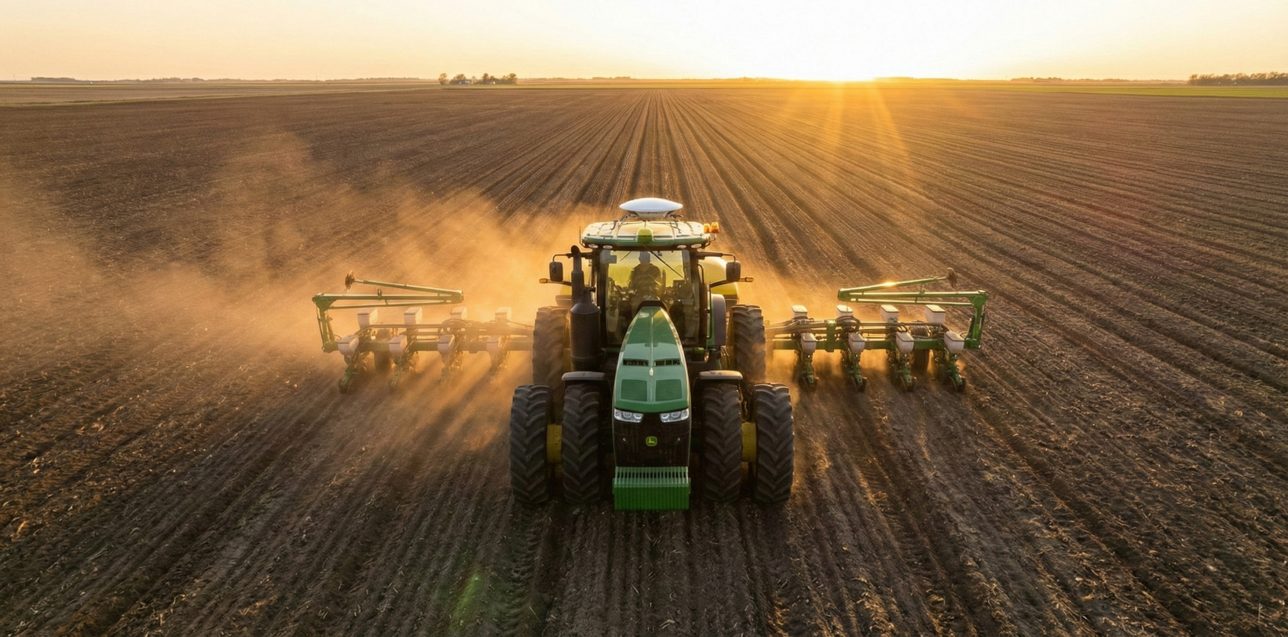
Precision farming is a closed-loop workflow: measure variability, georeference with GNSS/RTK, analyze zones, apply prescriptions with autosteer/section control, then verify with as-applied and yield maps. It highlights where RTK repeatability matters most and how to start simple quickly.

RTK Base station: Is Having One in 2026 Worth It?
Building your own RTK base station in 2026 can still pay off for offline work and compact areas, but network RTK via NTRIP is the default for most teams. Learn what production-grade requires—antenna siting, verified coordinates, correction delivery, monitoring, and datum/frame consistency.
When Centimeters Become a Utility: Why Precision Positioning Should Feel Boring
Centimeter-grade GNSS is becoming a “utility” as NTRIP RTK makes RTCM corrections available wherever you have internet access. It links the business impact (repeatable mapping, less rework, reliable autonomy) to the simple client flow.
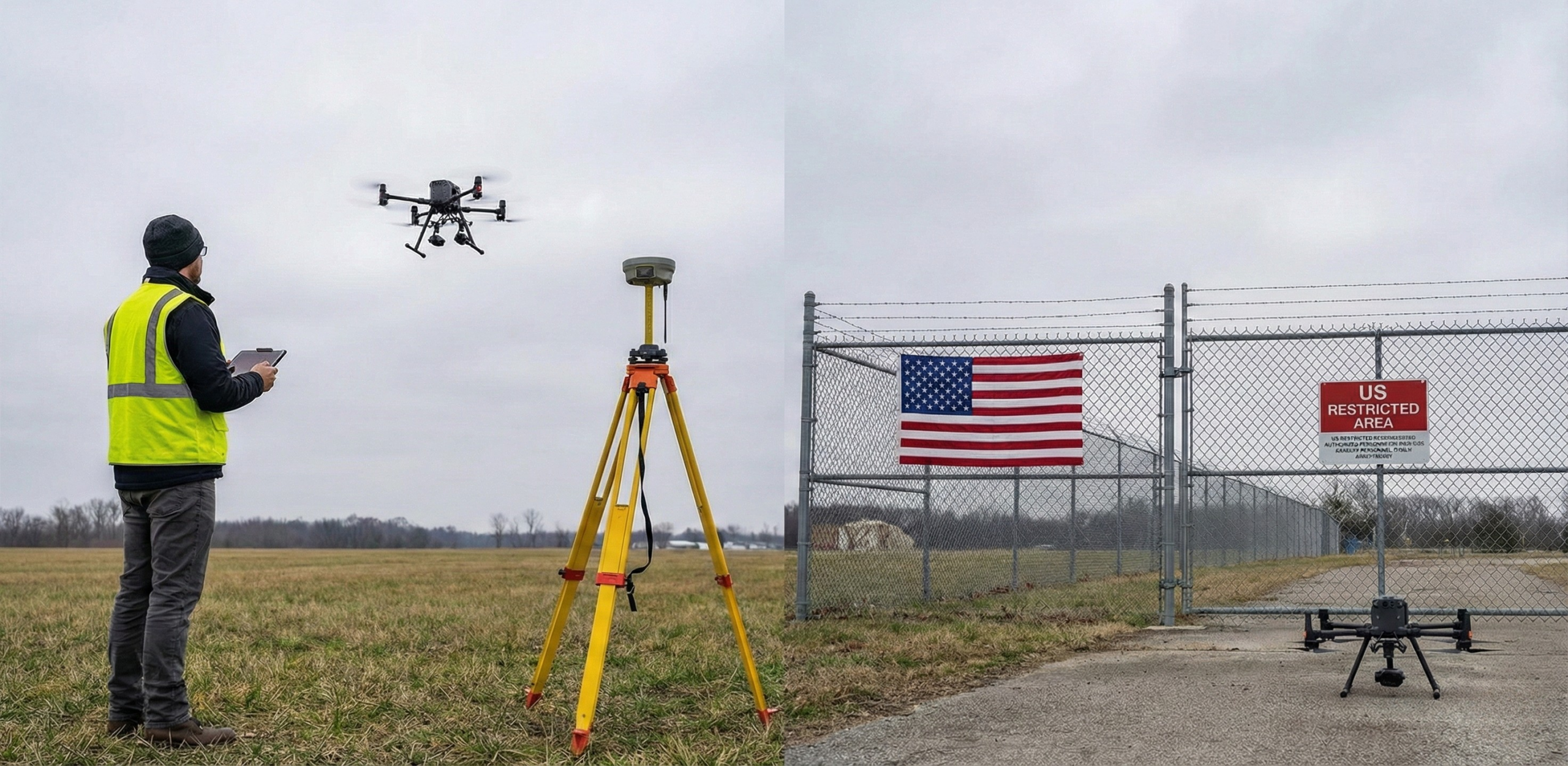
The U.S. Tightens the Drone Gate: What It Means for RTK for drones, RTK for DJI, and NTRIP RTK
U.S. approvals are tightening for new foreign-made drone models and certain critical components, creating procurement uncertainty for RTK fleets. The post recaps the December 2025 shift, what stays legal for existing drones, and a 2026 checklist to keep NTRIP RTK workflows stable.

How Distance Impacts NTRIP RTK Accuracy and How Network RTK Helps
Baseline distance erodes single-base RTK as atmospheric and other errors stop matching between base and rover. See representative accuracy degradation (≈0.6 cm near the base to ≈3.1 cm at 50 km) and how network RTK models regional errors to keep results steadier.
RTK Multipath: Why Your RTK Fix Drops Out in Cities and Forests
Multipath and signal blockage are common reasons an RTK Fix drops out or looks “good” while being wrong in cities, forests, and mountains. You’ll get a field checklist for mitigation—site choice, antenna placement, and QC signals like Fix/Float transitions and DOP limits.

RTK for Drones: Ultimate Precision Explained
RTK turns a drone’s meter-level GNSS into ~1–3 cm positioning by streaming RTCM corrections via NTRIP over cellular or Wi‑Fi. It covers the key components, why a nearby mountpoint matters, and the basic setup to reach and consistently maintain an RTK Fix.

KPIs That Matter for RTK: Key Metrics for High-Performance GNSS
High-performing RTK is measurable through KPIs like accuracy, availability, integrity, continuity, time‑to‑fix, fix rate, and correction latency/age. The post highlights practical targets and how to track them in logs and dashboards.