
Unitree Go2 Robot Dog with RTK on Construction Sites: BASTIDOR in Ontario
Partner spotlight · Ontario, Canada
BASTIDOR Intelligence Group is building a platform that records firestop penetrations and site conditions with robot dogs, drones and NFC tags before the next trade covers them. RTKdata’s RTK corrections provide the outdoor and aerial reference that ties those captures to one site coordinate system.
 RTKdata reseller partner since July 2026
Updated
At a Glance
BASTIDOR Intelligence Group Inc.
Construction compliance and site intelligence
Greater Toronto Area, Ontario, Canada
Unitree Go2 · DJI Matrice 4E · NFC tags
NTRIP RTK
Platform in development, first pilots in preparation
BASTIDOR Intelligence Group Inc. is an Ontario company building a site intelligence platform for construction documentation and compliance. The platform combines robot dogs, drones and NFC asset tags to document firestop penetrations and site conditions before concealment. RTKdata’s NTRIP corrections from the nearest reference station provide the centimeter-level spatial reference for the platform’s outdoor and aerial captures.
The Challenge: Documenting Firestop Penetrations Before the Next Trade Covers Them
Steven Ramirez knows the problem from the inside. He is a fourth-year union fire sprinkler fitter and also holds diplomas in Paralegal Studies and Legal Office Administration. Working on Tier-1 construction sites, he saw post-construction liability disputes and compliance failures come back to the same gap: there was no undeniable record linking what was built to where it was built. He founded BASTIDOR Intelligence Group to close that gap between physical construction and legally defensible spatial evidence.
Why concealed firestop penetrations become a construction liability
Sleeves, penetrations and firestopping can only be checked in a short window. Once drywall or concrete goes up, the physical evidence is out of sight. ASTM E2174, the standard practice for on-site inspection of installed firestop systems, is built around confirming that every required firestop is installed as the inspection documents specify. On most sites, the record behind that confirmation still consists of supervisor walk-throughs, low-resolution phone photos and paper logs.
When an unverified penetration ends up behind a finished wall, Ramirez puts the cost of forensic rework or a delayed occupancy permit easily in the hundreds of thousands of dollars. Reconstructing that history by hand takes 15 to 20 hours of forensic tracing per audit, in his estimate.
What a 3-meter GPS error does to a firestop record
Location is where these records break down. Standard GPS drifts by 2 to 5 meters, and according to GPS.gov accuracy gets worse near buildings. In Ramirez’s words, that turns a record into a legal “dud” in court and a spatial disaster on site. His example: if a firestop sleeve is logged with a 3-meter error, the BIM overlay can place it inside a solid concrete column or in a different room altogether. The photo still shows the sleeve, but no one can prove where it is.
The Solution: Robot Dogs, Drones and NFC Records on One RTK Reference
BASTIDOR’s answer is a Data-as-a-Service platform that captures a site from the ground and from the air and ties every capture to a physical asset record. Fire-code compliance is the first application. The same record supports site documentation, safety reviews, material logistics and forensic audit trails for Tier-1 general contractors, infrastructure developers and operators of large commercial events.
How robot dogs and drones capture a construction site
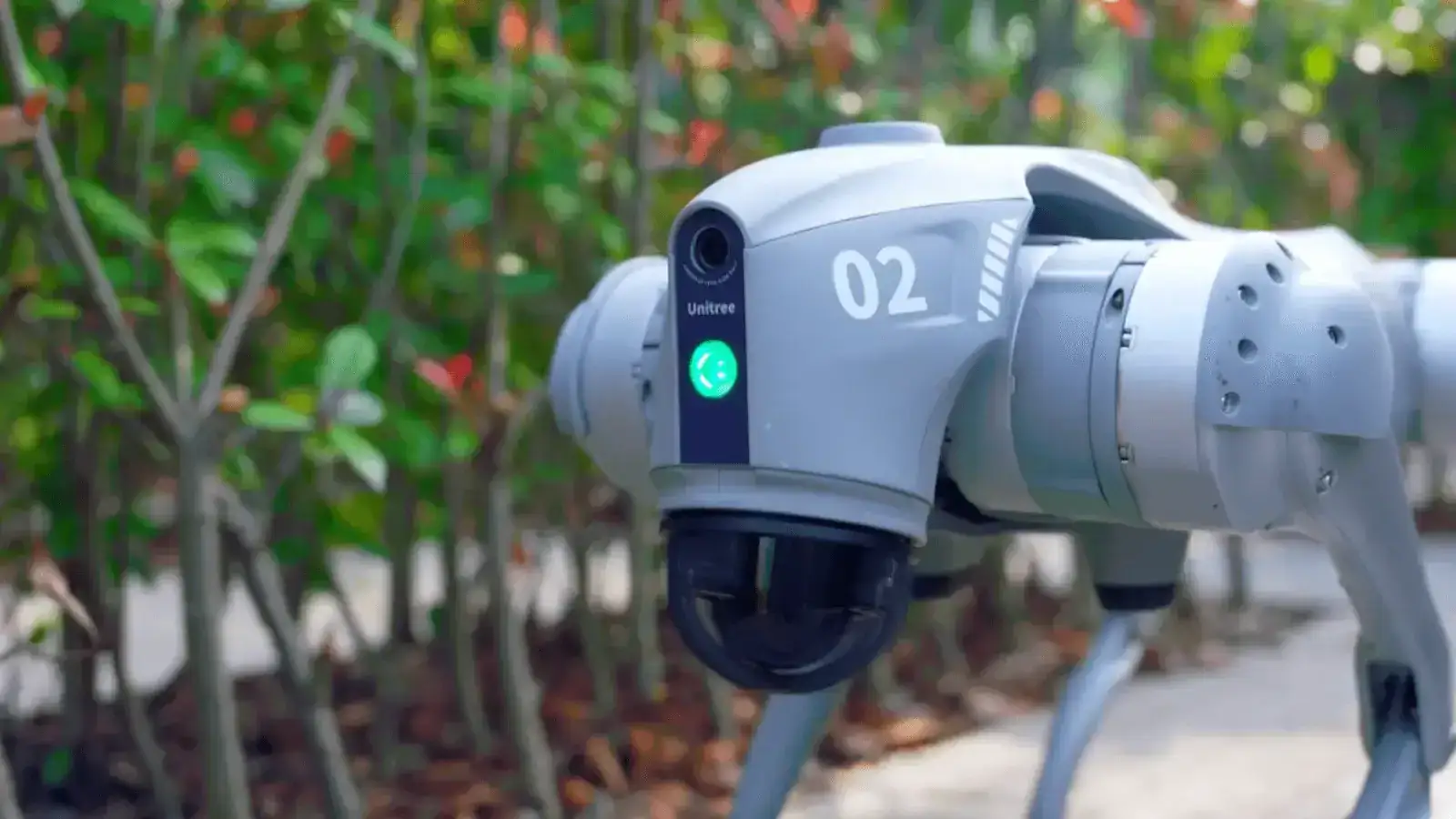
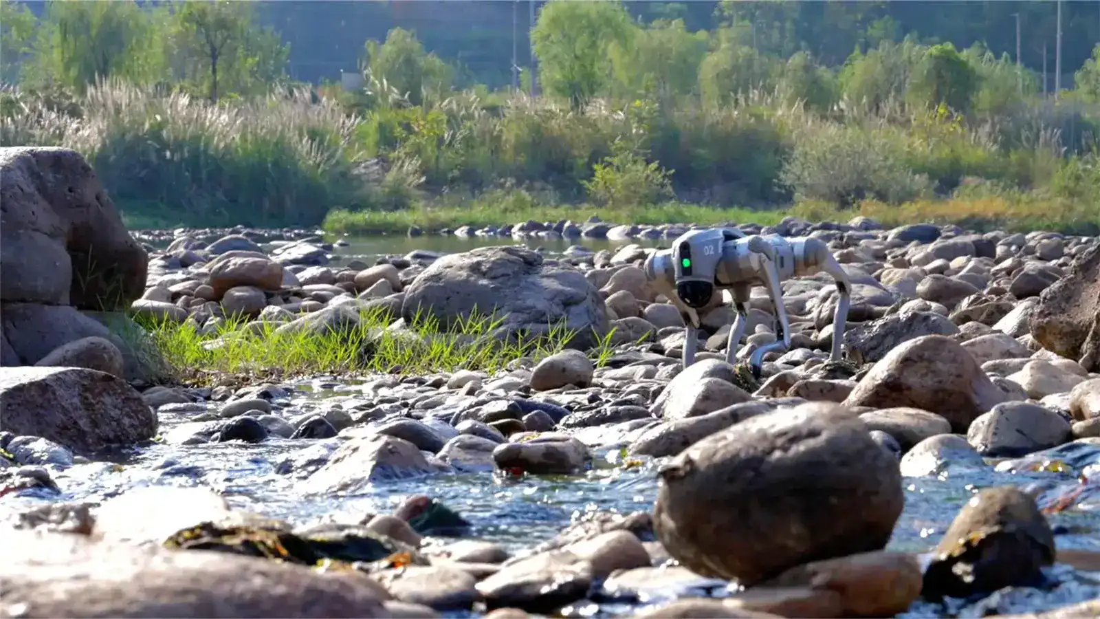
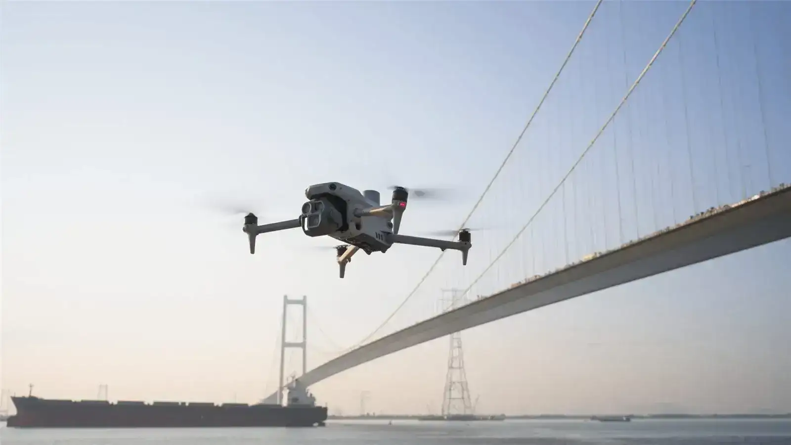
The platform is built around Unitree Go2 quadruped robots for ground robotics positioning, supported by a micromobility fleet that moves people and equipment across large sites. In the air, a DJI Neo 2 covers interiors, and the DJI Matrice 4E flies the RTK drone mapping missions. Ruggedized NFC tags in 9 mm and 25 mm formats, together with IoT telemetry, link each physical asset to its digital history: the digital thread that BASTIDOR’s dashboard is built on.
Why RTK positioning matters for construction compliance records
RTK solves the location half of the problem. RTK corrections for construction bring a GNSS receiver from meter-level error to 1 to 2 cm horizontally once it holds a fixed solution. For BASTIDOR, that puts drone captures and outdoor ground captures into one coordinate space: a record from a Matrice 4E flight and a record from a robot sweep point to the same spot on the building model.
DJI specifies the Matrice 4E at 1 cm + 1 ppm horizontal and 1.5 cm + 1 ppm vertical with an RTK fix (DJI specifications), and the aircraft takes RTKdata corrections through the Custom Network RTK setting in DJI Pilot 2 (Matrice 4E setup guide). Satellite corrections need a view of the sky, so RTK anchors the outdoor and aerial side of the site record: the reference that any indoor capture has to be registered against.
Why BASTIDOR chose an RTK network over private base stations in Toronto
Before choosing a correction service, BASTIDOR looked at running private base stations. In the dense urban construction environment of the Greater Toronto Area, the hardware overhead, baseline distance limits and multipath interference made that option prohibitive. With RTKdata’s network across Canada, each drone or robot connects over cellular data to the nearest reference station, and there is no base station to set up, move or guard.
“The setup was seamless, allowing us to focus on our software and data capture rather than managing GNSS infrastructure,” Ramirez says.
RTK license provisioning for drone and robot fleets
BASTIDOR joined RTKdata as a reseller partner in July 2026. In the reseller console, BASTIDOR can create and manage RTK licenses for its own customers, generate setup links, monitor accounts and use a demonstration license for presentations. The next step is an API integration, so that the BASTIDOR Portal provisions an RTK license on demand for each drone or robot asset and manages fleet credentials in one place.
Customer Testimonial
Steven RamirezPartnering with RTKdata provides BASTIDOR with the centimeter-level precision bedrock required to transform raw site telemetry into legally defensible spatial evidence. Their infrastructure bridges the gap between physical construction and indisputable digital compliance.
Founder and Director of Operations, BASTIDOR Intelligence Group Inc.
Where the Project Stands: First GTA Pilots in Preparation
Pilot target: a 50,000 sq ft floorplate in under 30 minutes
BASTIDOR is preparing its first pilots on multi-million-dollar commercial developments and industrial facilities in the Greater Toronto Area. Ramirez has set a clear target for them: sweep a floorplate of more than 50,000 square feet and log hundreds of multi-trade penetration points in under 30 minutes.
- Manual audit today: 15 to 20 hours of forensic tracing (founder estimate)
- Pilot target: 50,000+ sq ft floorplate, hundreds of penetration points, under 30 minutes
- Positioning: 1 to 2 cm horizontal with an RTK fix, against 2 to 5 m of standard GPS drift
- Aerial platform: DJI Matrice 4E, specified at 1 cm + 1 ppm horizontal with RTK
- Partnership: RTKdata reseller partner since July 2026
Technical Setup
| Component | Configuration |
|---|---|
| Correction service | RTKdata NTRIP RTK from the nearest reference station |
| Typical accuracy | 1–2 cm horizontal, 2–3 cm vertical with an RTK fix |
| Connection | Cellular NTRIP on each drone and robot |
| Aerial platforms | DJI Matrice 4E for RTK mapping, DJI Neo 2 for interiors |
| Ground platform | Unitree Go2 quadruped robot |
| Asset records | Ruggedized NFC tags (9 mm and 25 mm), IoT telemetry |
| Licensing | RTKdata reseller console today, API provisioning per asset planned |
| Region | Greater Toronto Area, Ontario, Canada |
What’s Next: Tier-1 Contracts, the Digital Thread Dashboard and API Provisioning
Over the next 6 to 12 months, BASTIDOR is focused on enterprise contracts with Tier-1 general contractors and on finishing its Digital Thread Dashboard. On the RTKdata side, the roadmap moves from the reseller console to full API integration, so that RTK access is provisioned per drone or robot directly in the BASTIDOR Portal.
Frequently Asked Questions
Why does construction documentation need RTK instead of standard GPS?
Standard GPS on a drone or robot drifts by 2 to 5 meters, enough to place a recorded sleeve or penetration in the wrong room on a BIM model. RTK corrections bring the position to 1 to 2 cm horizontally once the receiver holds a fixed solution, so outdoor ground and aerial captures share one coordinate space that indoor records can be registered against.
Can a robot dog use RTK corrections inside a building?
Not directly. RTK needs satellite signals, and those do not reach a receiver deep inside a structure. Indoors, the robot’s own sensors such as LiDAR or visual odometry carry the position, registered to control points that were measured with RTK outside, at openings or on the roof. RTK keeps those control points and all outdoor and aerial captures in one site reference.
Do I need my own RTK base station for construction sites in Toronto?
Usually not. A private base station adds hardware, setup time and baseline distance limits, and dense urban sites add multipath interference. An RTK correction service streams corrections over cellular data from the nearest reference station, so each drone or robot only needs an NTRIP login. BASTIDOR chose this route for its Greater Toronto Area projects.
Does the DJI Matrice 4E work with an NTRIP network RTK service?
Yes. The Matrice 4E has a built-in RTK module and accepts corrections from a third-party NTRIP service through the Custom Network RTK option in DJI Pilot 2. DJI specifies its RTK fix accuracy at 1 cm + 1 ppm horizontal and 1.5 cm + 1 ppm vertical. RTKdata’s setup guide walks through the configuration step by step.
How can a construction technology company resell RTK corrections?
Through a partner program. BASTIDOR started with RTKdata’s reseller console, where partners create and manage licenses for their own customers, generate setup links and monitor accounts. Companies with their own software can move on to API provisioning and issue an RTK license per drone or robot directly from their platform. Partners can start with a single license.