

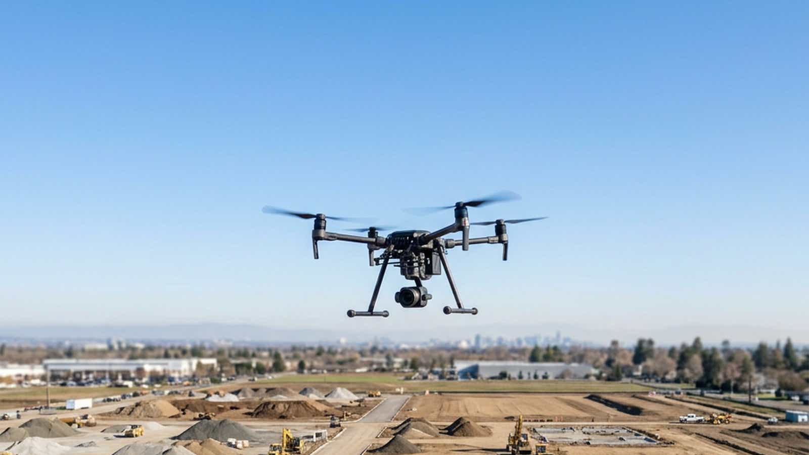
TL;DR Drone surveying produces georeferenced maps and models, such as an orthomosaic, a point cloud and a digital surface model, from overlapping aerial images or LiDAR returns. RTK corrects the position recorded for each image during the flight, which reduces the ground control a site needs but does not replace independent checkpoints. With onboard RTK and ground control combined, a peer-reviewed test (Štroner et al., 2020) on a DJI Phantom 4 RTK at 2.8 cm GSD reached about 2 cm RMSD in each of X and Y and about 3 cm in Z, apart from one flight at 7 cm in X.
Drone land surveying gives defensible results when a crew keeps four things apart: RTK, PPK, ground control and checkpoints. RTK drone surveying removes one source of error in the field, and it does not prove the map. This guide covers the field workflow, the accuracy to expect, how to validate it against the ASPRS standard, and the equipment a crew needs, with each accuracy figure tied to its source and conditions.
What Is Drone Surveying?
It is the practice of measuring a site from the air and turning those measurements into georeferenced products. The ASPRS Positional Accuracy Standards list the usual photogrammetric outputs: a digital elevation model, a digital surface model, a dense point cloud and an orthomosaic. A digital terrain model is the bare-earth surface, which ASPRS notes photogrammetry cannot see beneath dense vegetation or in deep shadows.
Two sensors do the capture. Drone photogrammetry reconstructs the surface from overlapping images, and LiDAR measures ranges to it. A drone topographic survey can use either. For a comparison with total stations and rovers, read our guide to drone mapping vs traditional survey.
How RTK Works in a Drone Survey
RTK (real-time kinematic) pairs the aircraft with a reference station at a known position. Both track the same satellites, and over a short baseline they see nearly the same atmospheric conditions, so the shared delays largely cancel (NGS single-base guidelines). With a network service, the station's data travels as RTCM corrections over NTRIP, usually through the remote controller's internet connection. Our drone RTK setup guide covers menus and credentials.
The result is a corrected camera position stored in each image's geotag. RTKdata's quick start says convergence "typically takes 5 to 20 seconds under open sky", and its Mavic 3 Enterprise guide gives 30 to 90 seconds on that aircraft. A FIX says the receiver has resolved its carrier-phase ambiguities, and NGS warns that multipath can make that resolution wrong. However, it says nothing yet about the finished map.
RTK, PPK and Ground Control Points: What Each One Corrects
These four tools do different jobs, and only one of them gives you evidence of map accuracy.
| Method | When it acts | What it removes | What it leaves |
|---|---|---|---|
| RTK | In flight, over a live link | Corrects geotags in real time, removing satellite and atmospheric error shared with the station | Camera-model and datum errors; gaps when the link drops |
| PPK | After the flight, from logged aircraft and base station GNSS data | Corrects the same geotags later, so a poor span can be reprocessed | An office step; Przybilla et al. note it cannot compensate for limited satellite reception |
| Ground control points | During processing | Tie the model to surveyed ground points; ASPRS describes the block being "rotated, scaled, and translated" into the coordinate system | Their own survey error; they cannot test themselves |
| Checkpoints | After processing | Nothing. They only measure the result | The error itself; ASPRS defines them as "excluded from the processing" |
RTK and GCPs vs Independent Checkpoints
RTK reduces the need for GCPs but does not remove the need for independent checkpoints. ASPRS says onboard RTK or PPK "greatly mitigates the need to rely upon ground control" and still calls surveyed control "highly recommended". Moving from a GCP drone workflow to RTK alone usually leaves the horizontal position sound while the height can shift. For example, Štroner et al. saw whole models shift vertically and had one flight with an unexplained 8 cm horizontal shift. They therefore called RTK without external verification "potentially very dangerous". Przybilla et al. report that RTK "leads to sufficient results if at least 1 GCP is introduced". However, one GCP left a systematic tilt on their moorland site, and Štroner et al. recommend at least the four corners.
Stott et al. found no vertical systematic error with zero GCPs on a Scottish river reach, yet they too recommend independent check points. On PPK, ASPRS calls it the most accurate of these methods, while Przybilla et al. found the presumed gain "not detectable" in one data set. Our guide to RTK vs PPK for drone mapping covers that choice and camera timing.
Network RTK vs a Local Base Station
With network RTK over NTRIP, the reference stations are already installed and you reach them through a login. On RTKdata's AUTO mountpoint, your device sends its approximate position and the caster "identifies the nearest reference station and begins streaming corrections from it" (connection reference). So "network" here means nearest-station selection, and the baseline you plan around is the distance to that station. NGS's guidelines contrast single-base work with real-time networks that interpolate errors across stations, which is a different method.
Baseline Length and Setup Time
Baseline length matters because error grows with it. DJI specifies the Mavic 3 Enterprise RTK module at 1 cm + 1 ppm horizontal with RTK Fix. Since 1 ppm adds 1 mm per kilometer, a 10 km baseline adds about 1 cm by that specification. NGS asks for baselines of 20 km or less at its Class RT3 and 10 km or less at its tightest class. Meanwhile, RTKdata's documentation recommends working within 15 km of a base station for best results. Our article on how distance affects NTRIP RTK accuracy works through the numbers.
| Factor | Network RTK (NTRIP) | Local base station |
|---|---|---|
| Baseline | Distance to the nearest station; check the coverage map first | Set by you; ASPRS describes bases "within or in close proximity to the project site" |
| Setup time | Enter credentials, then wait for FIX (up to about 90 seconds in the guides above) | 30 to 60 minutes for setup and teardown, by RTKdata's estimate in its DRONEWERX case study; longer on a new point |
| Base coordinates | Station positions come with the service; AUTO delivers NAD83(2011) epoch 2010.0 in the US (datum table) | Yours to establish; for a photogrammetry logging base, ASPRS asks for usually 20 minutes or more over a known point before and after flight, and an hour or longer both before and after on a new point |
| Best fit | Many sites with mobile coverage and a station in range | No mobile signal, or no station within a workable baseline |
A local base also moves responsibility for position onto the crew. On a new site with no internet, DJI's geospatial FAQ points to a PPK workflow, which still needs base station data.
The Drone Surveying Workflow, Step by Step
Plan the Mission: GSD, Overlap and Coordinate System
Start from the accuracy the client needs and work back. Ground sampling distance (GSD) is set by flying height, focal length and pixel size. In addition, ASPRS says the minimum acceptable GSD is "typically determined based on the project's desired level of accuracy". In the US, 14 CFR 107.51 caps altitude at 400 feet above ground level, with an exception for flights close to a structure.
For drone photogrammetry, ASPRS cites 80% front overlap and 60% side overlap.
Fix the coordinate reference system before the flight. GNSS receivers observe ellipsoid heights, and ASPRS names Geoid18 as the most common geoid model for converting them to NAVD88 in the US. DJI notes that the coordinate system of the images "depends on the NTRIP RTK correction source". In addition, our documentation warns that photogrammetry software frequently defaults to WGS84, so match the frame on both sides. Record the datum, epoch and geoid on every job.
Set Up Corrections and Checkpoints in the Field
Connect the controller, wait for FIX, and check a known point with the rover. NGS says a check shot should "ALWAYS" come first because it exposes wrong antenna heights or base coordinates. Next, set targets. ASPRS wants checkpoints well distributed, away from the control points, and surveyed to at least twice the accuracy required of the product.
Fly and Capture: Photogrammetry or LiDAR
ASPRS warns that image matching may be limited in dense foliage and on homogeneous textures such as new asphalt or water. It also says lidar would be a better option where vegetation covers the ground. However, a lidar drone survey still needs the same validation. Also, during capture, ASPRS recommends flying subsequent lines in opposing directions to improve camera calibration.
In the US, the FAA says a drone under 55 pounds can fly for work under Part 107, which requires a Remote Pilot Certificate. A drone that requires registration must also broadcast Remote ID, unless it flies within a FAA-Recognized Identification Area.
Process and Validate Before Delivery
ASPRS sets the order: run aerial triangulation, verify that systematic errors have been removed or minimized, read the checkpoint residuals, and only then generate deliverables. It also says the lever arm, the distance from the camera's exposure point to the GNSS antenna, should be provided by the manufacturer, solved in the adjustment or physically measured.
Drone Survey Accuracy: What to Expect and How to Report It
Receiver accuracy and map accuracy are different numbers. RTKdata's published 1-2 cm horizontal and 2-3 cm vertical figure (trial page, RTK FIX in open-sky conditions) describes the GNSS position, not the accuracy of an orthomosaic or surface. Our accuracy documentation is more specific: a 2 cm zone with reliable FIX, and a 2 to 10 cm zone where vertical is 1.5 to 2x worse than horizontal. Map accuracy is what you measure afterwards at checkpoints.
Published Accuracy Figures by Source
| Source | Measures | Figure | Conditions |
|---|---|---|---|
| ASPRS Addendum V | Onboard positioning method | PPK often 1 to 2 cm horizontal, 2 to 4 cm vertical; RTK typically 5 to 10 cm | "Used properly" (PPK); "set up properly" with a nearby multi-frequency base (RTK), a value ASPRS says is improving |
| Štroner et al., 2020 | Model at checkpoints | With GCPs added, RMSD about 2 cm X, 2 cm Y, 3 cm Z, one flight 7 cm in X. On RTK alone, vertical shift up to 14 cm at one site and 9 cm at the other, one flight 8 cm in X | Phantom 4 RTK, RTK with and without GCPs, GSD 2.8 cm, two sites of about 300 m x 300 m, corrections from the CZEPOS permanent-station network |
| Przybilla et al., 2020 | Model at checkpoints | With RTK and no GCP, height deviation well over 10 cm on two of four systems at one site; under 4 cm in nadir and 45° flights on a 6,000 m² plot | Phantom 4 RTK and Matrice 210 RTK, RTK, GSD 10 to 18 mm |
| Stott et al., 2020 | Model at check points | Z RMSE 6.7 cm with no GCPs, 7.4 cm with 5 GCPs (X and Y about 2.5 cm at 39 targets) | Phantom 4 RTK, RTK, GSD 2.28 cm, 2 km x 0.5 km reach, 3,300 check points, local base on a marked point in each of five blocks, images 20° off nadir in opposing strips |
| DJI Zenmuse L2 | LiDAR system | 5 cm horizontal, 4 cm vertical at 150 m | DJI laboratory environment, RTK FIX, hard-ground check points, DJI Terra point cloud optimization on (8 cm horizontal with it off), above the Part 107 cap; manufacturer claim |
Horizontal vs Vertical Accuracy and the GSD Rule
The GSD rule is a rule of thumb, not a standard. Pix4D's blog says a correctly reconstructed project reaches absolute accuracy of one to two GSD horizontally and one to three GSD vertically. Its support article labels those figures relative accuracy, adding that absolute accuracy "cannot be higher than the accuracy of image geolocation, or GCPs' accuracy".
Without ground control, vertical is where the studies above found the largest errors, so plan to it. Use the rule for flight planning and never as a reported result: ASPRS says its standards "do not endorse the use of GSD, map scale, or contour interval to express product accuracy".
Checkpoints, RMSE and the ASPRS Standard
The US reference used here is the ASPRS Positional Accuracy Standards for Digital Geospatial Data, Edition 2, Version 2 (2024), the latest edition we could find on November 2, 2026. Its main requirements:
- RMSE only. Edition 2 eliminated the 95% confidence level as an accuracy measure.
- At least 30 checkpoints. That is the minimum to be "considered fully compliant", capped at 120 on large projects. Testing with fewer calls for a special statement giving the number used.
- Accurate, independent points. Checkpoints must be at least two times more accurate than the required product.
Report RMSE in X, Y and Z separately, then state the class. ASPRS expresses horizontal accuracy as RMSEH, derived from RMSEX and RMSEY, vertical accuracy as RMSEV and three-dimensional accuracy as RMSE3D. It also requires the mean, median and standard deviation, which help reveal systematic shifts.
What Degrades Accuracy in the Field
- Baseline and sky view. RTKdata's documentation names distance to the nearest station as the primary factor.
- Multipath. The same page calls signals bouncing off buildings or metal "the #1 accuracy killer after distance".
Drone Surveying Equipment Checklist
A working drone surveying equipment list covers what flies, what corrects it, and what checks the result.
Airframe and Sensor
ASPRS describes three aircraft types. Rotary-wing aircraft hold more consistent overlap, fly slower and lower, and suit terrain following and small sites. By contrast, fixed-wing aircraft offer endurance over large areas but typically need launch and landing zones, which a hybrid or fixed-wing VTOL design may avoid.
GNSS and Correction Source
DJI says an Enterprise RTK drone can connect directly to an NTRIP Network RTK service, and its Mavic 3 Enterprise manual names the setting Custom Network RTK. The ADVOLARE SkyView case study shows this in practice: on an outdoor storage survey in Switzerland, a DJI Matrice 4T held a stable RTK fix throughout the flight using its native NTRIP client. However, it publishes no checkpoint statistics, so read it as evidence of the workflow and not of map accuracy.
Software and Field Gear
For drone surveying software, the sources above used Agisoft Metashape, Pix4D and DJI Terra. Downstream, Autodesk's Civil 3D command reference lists TIN surfaces from point cloud files and cut, fill and net volume calculations. In the field, carry a GNSS rover for control and checkpoints (see RTK for surveying). Observe each point as ASPRS describes, with at least three 180-second measurements that agree within 20 mm. Also pack targets, a phone hotspot or 4G dongle for the controller, and spare batteries.
Where Drone Surveying Fits and Where It Does Not
It fits open sites where a continuous surface is the deliverable: topographic mapping, contours, cut and fill, and repeat stockpile volumes. Volumes are also where a shift hurts: a 5 cm vertical bias across 10 hectares is 5,000 cubic meters, which is why checkpoints belong on every repeat job.
It fits less well in three cases. Photogrammetry struggles under dense foliage and on uniform textures. For pipe inverts, structure inverts and bridge abutments, NGS says even RTK rover work at its Class RT3 should take elevations from leveling or a total station. A drone surface is therefore not the tool for them. Our documentation says the 2 to 10 cm zone suits photogrammetry with GCPs, but not survey-grade control points or precise boundary surveys. Licensing is a separate matter: ASPRS recommends that a licensed professional land surveyor supervise and certify ground control survey work, even in jurisdictions that do not legally require it.
FAQ
How do I become a drone surveyor?
In the US, flying for work under Part 107 requires an FAA Remote Pilot Certificate. Surveying licensure is separate and varies by jurisdiction, and ASPRS recommends a licensed professional land surveyor supervise and certify ground control work, even where the law does not require it.
How are drones used in surveying?
Mainly on open sites where a continuous surface is the deliverable: topographic mapping, contours, cut and fill, and repeat volume surveys. They are a poor fit for pipe inverts and similar critical elevations, where NGS guidance points to leveling or a total station.
What is the cost of a drone survey?
There is no fixed price, because site size, accuracy and deliverables set it. Apex Surveying & Mapping reports published US public contract rates of $102.11 to $218.95 per hour for drone operators, and $100 to $130 per hour for point cloud and CAD work. For a whole job, SkyeBrowse reports about $50 to $150 per acre for an engineering topo with ground control points.
Do you need GCPs with RTK?
Fewer, but ASPRS still highly recommends them, and published tests disagree on the number. Przybilla et al. found at least one necessary, while Stott et al. found none necessary on one river reach, flying from a local base in each block. Either way, keep independent checkpoints.
What is the best drone for surveying?
No single model fits every job. Rotary-wing aircraft suit small sites and terrain following, while fixed-wing and hybrid designs cover larger areas. Choose an RTK or PPK capable aircraft whose sensor meets your required GSD, then test it against checkpoints.

Leads marketing, growth, and customer-facing communication at RTKdata and builds the demand engine across paid, content, and outreach.